
Albany Harbour Swim
- Mar 27, 2027
- Distance: 4km
At a glance
- Next edition date
- March 27, 2027
- Distances
- 4 km
- Where
- Sea · Princess Royal Sailing Club, Albany, Western Australia, Australia
- Entry fee
- 80 AUD
- Registration
- albanysurfclub.com.au
About the race
Princess Royal Harbour stretches eight kilometres across calm waters. Organised by the Albany Surf Life Saving Club, the Albany Harbour Swim brings swimmers together for a point-to-point crossing that traverses Princess Royal Harbour. Swimmers gather at the Princess Royal Sailing Club before launching into the water for the 4,000-metre crossing, setting their sights across the open basin toward the finish line at Albany Peace Park. The event accommodates a wide spectrum of endurance swimmers by allowing solo, duo, or relay team entries. Surface conditions across the harbour are typically calm with gentle chop, providing a steady line for breathing and navigation. Past editions capture the unique sensation of this straight line over the bay.
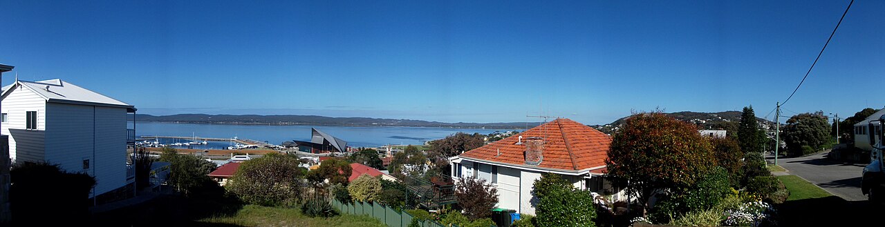
In 2015, the race unfolded in pristine and spectacular conditions, with swimmers remarking that the water was lovely yet so wide that you feel as though you have travelled nowhere until the opposite shore suddenly draws close. The course is also managed around local sea states: in 2014, the 4-kilometre distance was swum in reverse order compared to previous years, taking full advantage of favorable conditions across the basin.
Princess Royal Harbour: shallow basin and wartime anchorage
Underneath your stroke lies an elliptical marine basin eight kilometres long and four kilometres wide, covering 28.8 square kilometres of water. Despite its broad expanse, the harbour remains remarkably shallow, maintaining an average water depth of just 3.1 metres at mean sea level. Before industrial navigation reshaped the seafloor, the natural depth across the entire basin was less than two metres, requiring extensive dredging in 1901 and a second dredging campaign to deepen the entrance channel in 1952. Because large sailing vessels initially could not navigate these shallow shallows to enter Princess Royal Harbour during early settlement, nearby Middleton Beach served as the primary coastal landing point for incoming provisions and supplies.
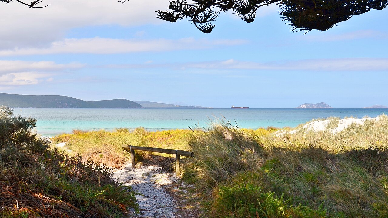
The waters also hold far older cultural roots: the Menang Noongar people traditionally fished these coastal inlets, engineering fish traps at Emu Point and along the Kalgan River. British navigator George Vancouver first explored these harbour waters in September 1791. More than a century later, the sheltered basin became a critical assembly ground when a large convoy of Australian troops gathered inside and departed together in November 1914. During the Second World War, the enclosed anchorage was put to strategic naval use again as an auxiliary submarine base for the United States Navy's 7th Fleet.
Point King and the channel into King George Sound
About three kilometres from the swimming area stands Point King Lighthouse. Perched fourteen metres above the high water mark, the station was erected as the first navigational light for the Port of Albany and was only the second lighthouse built along the Western Australian coastline. The light began operations on New Year's Day in 1858, burning an oil-fired lamp that cast its warning beam 19 kilometres across the open sea. Operations finally ceased in June 1911. Nearby rises the rugged silhouette of the Vancouver Peninsula. In 2000, the peninsula was officially separated from Frenchman Bay. The peninsula forms part of the traditional settlement territory of the Menang Aboriginal people and remains largely undeveloped, with Camp Quaranup at Geake Point standing as its sole residential structure.
Lake Seppings spans 1.1 kilometres in length and is protected within a 17.1-hectare nature reserve, where cockle shells remain preserved in the surrounding soil from its marine origins. The wetland is a thriving sanctuary where over one hundred bird species have been recorded.
King George Sound: seagrass meadows and maritime wrecks
Just outside the entrance to the harbour opens King George Sound, a vast marine gulf spanning 110 square kilometres with depths dropping between 10 and 35 metres. Tides in the sound remain gentle, with a normal daily tidal range of 0.4 metres and spring tides reaching only 1.1 metres, maintaining stable swimming conditions throughout the region. The Ellen Cove Boardwalk winds along the hillside above the jetty, offering expansive views over King George Sound and Middleton Bay. On the sandy floor of King George Sound, rich meadows of Posidonia and Amphibolis seagrass spread across the seabed, filtering currents and oxygenating the coastal water. Historic wrecks lie embedded in this marine environment: in the shallows of Frenchman Bay, beachgoers can still spot the wooden timbers of the whaling barque Fanny Nicholson, which ran ashore in 1872.
In deeper water near Seal Island, the scuttled guided missile destroyer HMAS Perth rests at a depth of 35 metres, sunk in 2001 to serve as a dive wreck and artificial reef. Around the sound's northern curve, Middleton Beach is known to the Noongar people as Binalup, translating to the place of first light. Just 120 metres off the beach, an artificial surf reef constructed from 70,000 tonnes of granite sits submerged beneath the waves.
Mistaken Island: penguin burrows and whale migrations
Situated just 120 metres away from the Vancouver Peninsula, Mistaken Island rests quietly inside the perimeter of King George Sound. In 1826, the British established a quarantine station on the island at the northern end of Goode Beach. Shore-based whaling operations also took place from the island during the 1800s. The islet earned its unusual name from early newcomers who mistook the burrows of native little penguins for ordinary rabbit holes. Farther down the coast, Misery Beach originally earned its name from the whaling station that operated there until 1978, which caused butchered offal to wash ashore and stain the water and sand red. That bloody legacy ended for good when the Albany facility—the last land-based whaling station in the southern hemisphere and the English-speaking world—closed its doors in 1978.
Mistaken Island was designated as a Class 1A Nature Reserve covering 12 hectares in 1971. Today, the pristine conditions around Mistaken Island are utilized for commercial mussel farming. In the open waters of the sound, Southern Right and Humpback whales arrive between July and October to mate and calve, occasionally swimming within 20 to 30 metres of the sand, completing a coastal sanctuary that celebrates its living waters.
Course
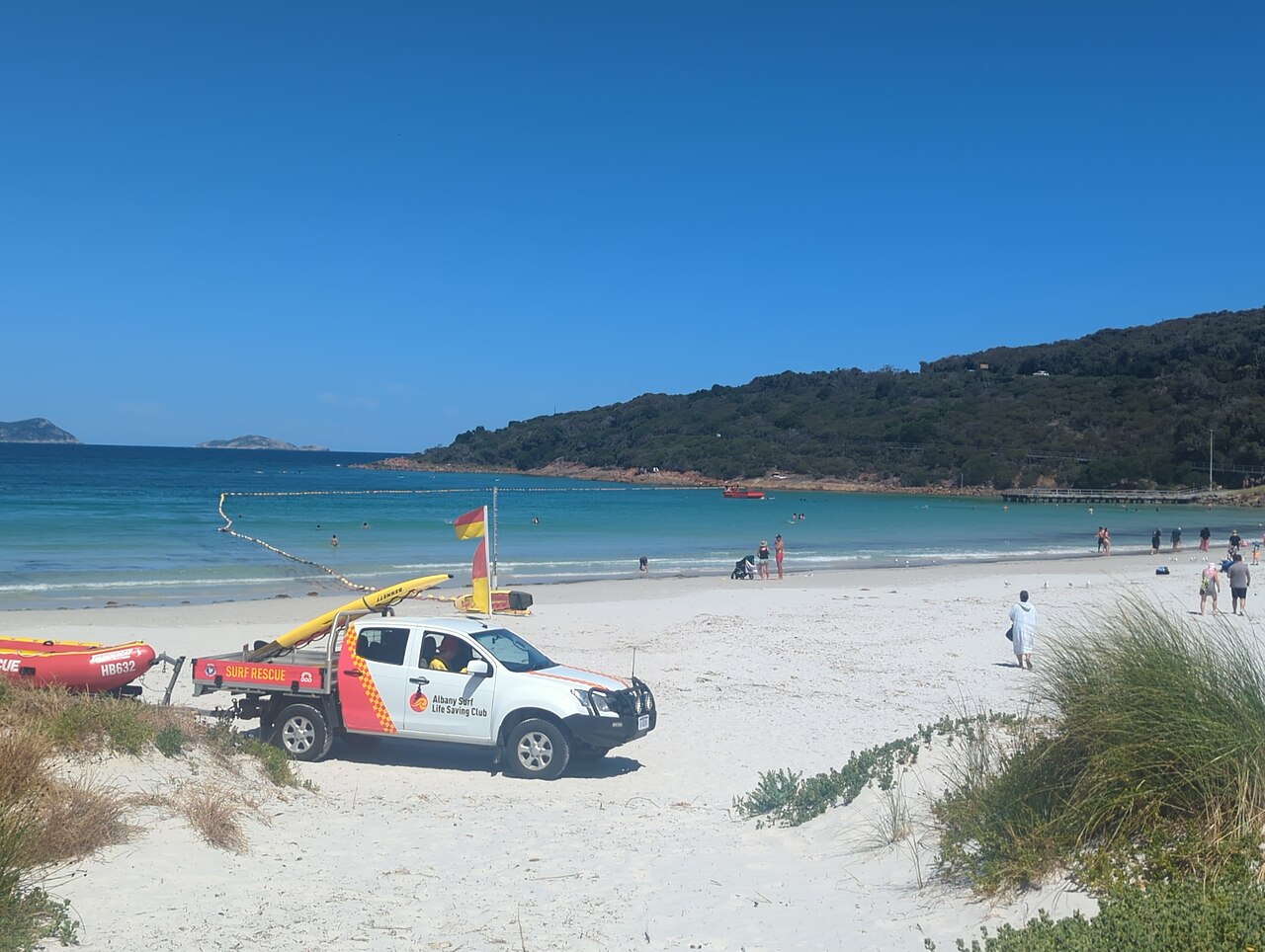
A point-to-point course starting at the Princess Royal Sailing Club and finishing at Albany Peace Park. The route crosses the heart of the harbour, offering calm water and expansive views.
Previous editions
- 2026Apr 4, 2026
How to get there
Albany Harbour Swim
Frequently asked questions
- When is Albany Harbour Swim?
- Albany Harbour Swim takes place on March 27, 2027.
- What distances does Albany Harbour Swim offer?
- Albany Harbour Swim has a single distance: 4 km.
- How much is the entry fee for Albany Harbour Swim?
- The entry fee is 80 AUD.
- Where does Albany Harbour Swim take place?
- Albany Harbour Swim is a sea swim. Location: Princess Royal Sailing Club, Albany, Western Australia, Australia.
- How do I register for Albany Harbour Swim?
- The reference page for registering for Albany Harbour Swim is https://albanysurfclub.com.au/feature-event/albany-harbour-swim-2/.
Where to stay
Albany offers a variety of stay options ranging from historic colonial-era guesthouses near the central business district to modern apartments overlooking the harbour. Coastal motels and holiday parks located slightly further from the town centre provide more budget-friendly alternatives. During the Easter period, booking in advance is essential as the town experiences high occupancy. Prices typically range from $150 to $350 per night depending on proximity to the foreshore and the level of amenities.
Things to do nearby
Beyond the water, the region is defined by the granite formations of the Torndirrup National Park and the historic whaling station museum. Visitors often explore the local vineyard trails in the Great Southern region or hike the Munda Biddi Trail segments that pass near the coast. Kayaking in the Kalgan River or visiting the local farmers' markets provides a balanced approach to an active race weekend in the Great Southern.
Swimmers
Similar races


Comments
Transparency: some links on this page (stays, flights, experiences, gear) are affiliate links — if you book or buy through them, Omniathlon may earn a commission from the partner at no extra cost to you. As an Amazon Associate we earn from qualifying purchases.