
Derwent River Big Swim — Hobart
- Feb 15, 2026
- Last edition date
- Distances from 14km to 49km
At a glance
- Last edition date
- February 15, 2026
- Distances
- 14 km · 22.3 km · 26.8 km · 30 km · 34 km · 49 km
- Where
- River · Derwent River, Hobart, Tasmania, Australia
- Wetsuit
- Rules regarding water temperature and safety requirements are determined in coordination with the assigned pilot.
- Registration
- derwentriverbigswim.com
About the race
Swimming down the Derwent River means stepping into pitch-black waters in the middle of the night, tracking lit bridges down one of the deepest natural harbours on the planet. The Derwent River Big Swim is an open water marathon swimming event held along the Derwent River in Hobart, Tasmania. It stands as one of the ultimate tests of endurance, drawing dedicated marathon swimmers to pure, uninterrupted stretches of tidal water.
Derwent River Big Swim: courses, night starts, and the Triple Crown
The Derwent River Big Swim holds an esteemed position on the global ultra-marathon circuit as part of the Australian Triple Crown of Marathon Swimming. The classic 34-kilometre river course carries deep historical resonance: Des Renford was the first person to successfully complete the 34 km distance on January 25, 1975, setting the standard for all who follow his line down the valley. Rather than mass pack races, the event is open exclusively to experienced swimmers who meet rigorous safety and endurance prerequisites. Each attempt is conducted as a solo swim accompanied by a dedicated pilot boat, scheduled meticulously around weather patterns, local tidal currents, and seasonal water conditions. Official crossings are organized across Tasmania's summer window, with the main swim season running from November through March.
Beyond the flagship 34 km crossing, the organization sanctions an extraordinary roster of marathon courses tailored to different aquatic environments. Swimmers seeking the supreme tidal challenge can tackle the 49 km ultra-marathon from New Norfolk Bridge down to Opossum Bay, or opt for river-to-harbour courses including the 30 km swim from Bowen Bridge to Iron Pot Lighthouse and the 22.3 km test from the Tasman Bridge out to Iron Pot Lighthouse. For pure inland freshwater endurance, the program also oversees the 14 km freshwater marathon across Lake St Clair, known natively as leeawulenna, as well as the 26.84 km freshwater ultra-marathon across Yingina, or Great Lake. Setting out on the long Derwent crossing often begins well before dawn, with swimmers stepping into ink-black water.
The initial entry into complete darkness can feel startling, with swimmers reporting that the profound absence of light amplifies every sensory detail and creates an intense bubble of mental focus. Yet the river is often glassy and still in the early morning hours, and the darkness is steadily guided by your escort boat and the brilliant beacons of distant bridges spanning the waterway. Endurance is tested as the morning opens, with participants sometimes battling stubborn river headwinds for hours. Later down the course, sighting the distant structure of the Tasman Bridge offers both relief and a stern psychological hurdle, signalling that a gruelling five kilometres of hard swimming still lie ahead.
The Derwent River: tidal salt wedge, cold flow, and Storm Bay
The Derwent River is a dynamic hydrological system that changes character beneath your strokes as you travel downstream. Fed by cool runoff from its upper reaches, the Derwent is a true tidal river where descending fresh water collides with dense marine salt water, with ocean tides pushing a saltwater wedge upwards of twenty kilometres inland from the mouth. This shifting salinity alters your buoyancy and rhythm as you transition from river current into coastal estuary swells. Temperature is another defining factor, demanding serious acclimatization and grit. Water temperatures in the Derwent typically hover between 13°C (55 °F) and 15°C (59 °F) across the year. Over the course of the Southern Hemisphere summer, coastal waters around Hobart warm from an average of 12.5°C (55 °F) in September to roughly 16.5°C (62 °F) in February, occasionally providing unseasonably mild pockets where river readings reach 18°C (64 °F) during peak periods.
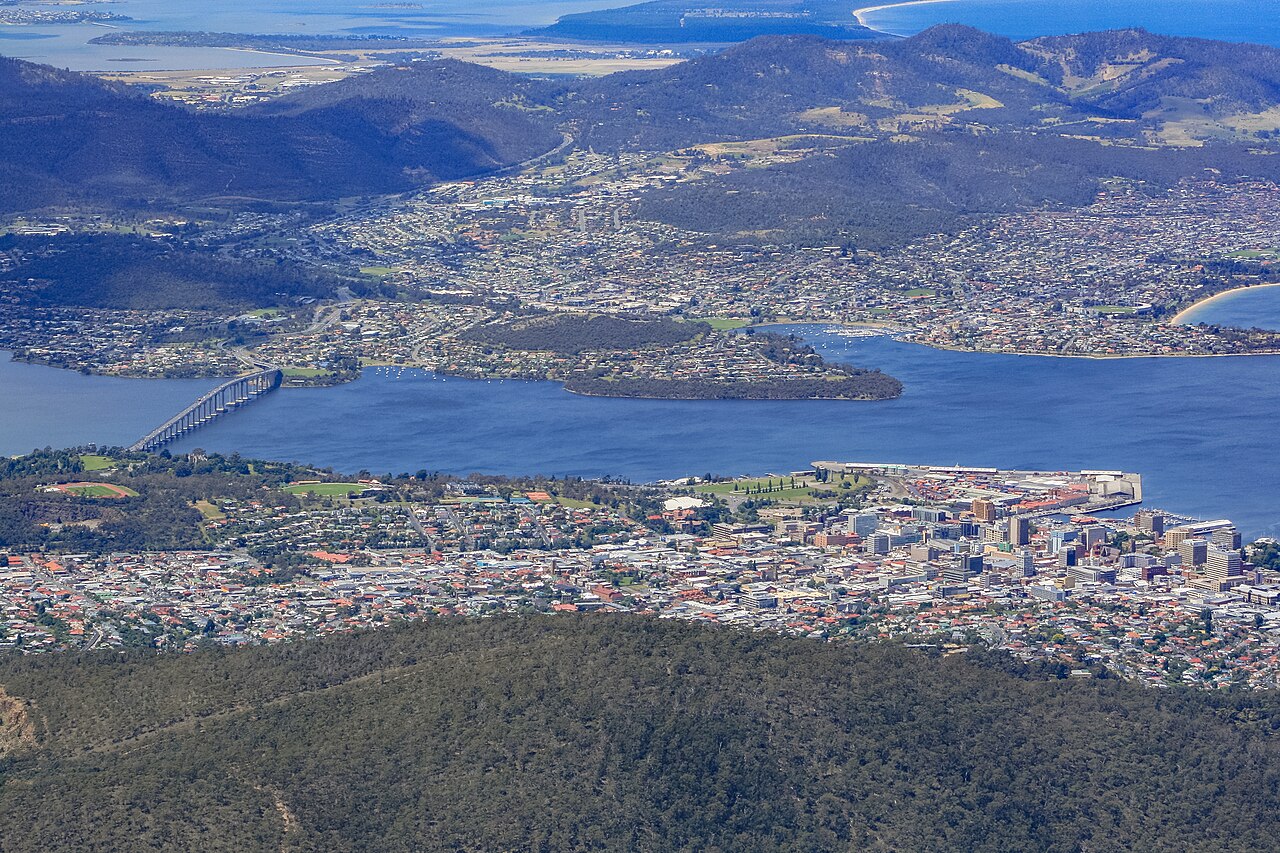
The lower Derwent opens out into a sweeping natural waterway, recognized globally as the second-deepest natural port in the world. Swimmers navigating the final stretches head toward Storm Bay, where the river mouth empties between the South Arm Peninsula, the historic marker of Iron Pot, and Betsey Island.
Sullivans Cove and the whaling waterfront along the river
As the river widens toward central Hobart, the course parallels the historic cradle of Tasmanian maritime settlement. European settlement along the River Derwent initially began on the eastern shore at Risdon Cove in 1803, before Lieutenant-Governor David Collins permanently relocated the colony to Sullivans Cove on the western shore in February 1804. That landing party established their foothold by stepping ashore at rocky Hunter Island, an outcrop that was eventually joined to the mainland through coastal infill. Throughout the nineteenth century, the Derwent served as a bustling hub for the southern whaling and sealing trades across the Southern Ocean. Along the cove foreshore, Salamanca Place grew up around the former Princes Wharf to serve the port and its whaling fleets, transitioning from an area once called The Cottage Green.
Beginning in the 1830s, substantial sandstone warehouses were erected along the water's edge to store barrels of pungent whale oil alongside overseas cargo. To bridge the steep waterfront with the residential cottages above, the stone stairway known as Kelly's Steps was cut during the whaling boom to link the wharves with Battery Point. As commercial whaling waned later in the nineteenth century, these versatile sandstone warehouses were repurposed for processing and storing Tasmania's flourishing export fruit crops, preserving the historic streetscape that still lines the water today.
The river approaches: coastal batteries, Iron Pot, and the Tasman Bridge
In 1829, a semaphore station and signal mast were erected on the ridge above Mulgrave Battery to communicate with ships entering the mouth of the river. At Queen's Battery, archaeological digs uncovered an early nineteenth-century hot shot oven, constructed specifically to heat solid iron cannonballs glowing red to set hostile wooden ships ablaze. On the eastern shore stand the remnants of Kangaroo Battery, a distinctive pentagon-shaped stone fort constructed into the bluffs above the river cliffs with subterranean tunnels cut into solid rock. Closer to the seaward gateway, Fort Direction was built near the mouth of the Derwent in 1939, established to defend Hobart's vital deep port and industrial facilities throughout the Second World War.
Dominating the skyline on your approach to the city is the Tasman Bridge, an unmistakable physical and emotional milestone for any Derwent swimmer. The bridge is indelibly etched in Hobart history by the 1975 Tasman Bridge disaster, when a bulk ore carrier struck the pylons, collapsing spans into the water and severing the eastern and western shores.
Sullivans Cove today: historic docks, fishing fleets, and polar vessels
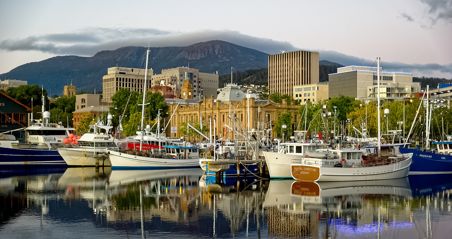
Once your solo journey down the Derwent is verified and celebrated, Sullivans Cove offers an ideal maritime setting to recover and take in Hobart's seafaring life. At the center of the waterfront lies Constitution Dock, an atmospheric marina enclosed within heavy stone seawalls right on the edge of the river. Here, salt air mixes with the bustle of dockside cafes, while urban platypuses quietly make their home nearby in the freshwater shallows of the Hobart Rivulet. Just alongside stands Victoria Dock, constructed in 1891 along the Sullivans Cove waterfront. This working haven continues to serve as the bustling primary home port for Tasmania's commercial fishing fleet. Over the decades, Princes Wharf has adapted to shifting ocean traffic, from welcoming royal arrivals at Princes Steps in 1868 and housing bulk cargo in Shed No. 3, to expanding via reclaimed land in the 1960s to accommodate passenger ferries.
Today, the end of the wharf houses the CSIRO Marine Laboratories, acting as the departure berth for the marine research vessel RV Investigator and serving as a gateway for polar expedition ships charting courses into the ice of Antarctica. It is a fitting maritime backdrop to an ultra-marathon that tests your limits against the wild, tidal waters of Tasmania.
Sources: Hobart
Course
Freshwater marathon swim in Lake St Clair, located in the Central Highlands of Tasmania, forming the southern end of the Cradle Mountain-Lake St Clair National Park.
Marathon swim starting at the Tasman Bridge on the Derwent River and finishing at the Iron Pot Lighthouse at Storm Bay.
Freshwater ultra-marathon swim in Yingina / Great Lake, a natural lake and man-made reservoir in the central northern region of Tasmania.
Marathon swim starting at the Bowen Bridge on the Derwent River and finishing at the Iron Pot Lighthouse at Storm Bay.
The original ultra-marathon swim starting at New Norfolk Bridge in the historic town of New Norfolk and finishing beneath the Tasman Bridge in Hobart.
Ultra-marathon swim starting at the New Norfolk Bridge in the historic town of New Norfolk and finishing at Opossum Bay.
Awards
Swims are ratified and eligible for the Australian Triple Crown.
How to get there
Derwent River Big Swim — Hobart
Frequently asked questions
- When was the last edition of Derwent River Big Swim — Hobart?
- The last edition of Derwent River Big Swim — Hobart took place on February 15, 2026.
- What distances does Derwent River Big Swim — Hobart offer?
- Derwent River Big Swim — Hobart offers 14 km, 22.3 km, 26.8 km, 30 km, 34 km, and 49 km.
- Is a wetsuit required at Derwent River Big Swim — Hobart?
- Rules regarding water temperature and safety requirements are determined in coordination with the assigned pilot.
- Where does Derwent River Big Swim — Hobart take place?
- Derwent River Big Swim — Hobart is a river swim. Location: Derwent River, Hobart, Tasmania, Australia.
- How do I register for Derwent River Big Swim — Hobart?
- The reference page for registering for Derwent River Big Swim — Hobart is https://www.derwentriverbigswim.com/how-to-register.
Where to stay
Hobart offers a diverse range of stays, from historic boutique hotels nestled along the 19th-century docks to modern apartments overlooking the estuary. For those wanting proximity to the river, look for converted warehouses or traditional 'fishermen-style' cottages in the Battery Point or Sullivans Cove areas. If you prefer a more rugged experience, there are several camping and caravan parks within reach of the river access points. Expect to pay between $150 and $450 per night depending on the proximity to the waterfront and the level of luxury.
Things to do nearby
Beyond the race, the Hobart region is defined by its proximity to wild landscapes and colonial heritage. Spend your recovery days exploring the local distilleries and cellar doors that feature cool-climate Tasmanian wines and spirits. For active downtime, kayak or SUP through the quieter inlets of the Derwent, or take a day hike up the trails of kunanyi / Mount Wellington for a panoramic view of the course you just conquered. Alternatively, visit the historic site of Port Arthur to delve into the island’s convict history.
Swimmers
Other races by this organiser
- 4 Bridges to Lighthouse SwimNew Norfolk, AU
Similar races


Comments
Transparency: some links on this page (stays, flights, experiences, gear) are affiliate links — if you book or buy through them, Omniathlon may earn a commission from the partner at no extra cost to you. As an Amazon Associate we earn from qualifying purchases.