
New World Harbour Race
- Nov 15, 2026
- Distance: 1.6km
At a glance
- Next edition date
- November 15, 2026
- Distances
- 1.6 km
- Where
- Sea · Victoria Harbour, from Wan Chai (Golden Bauhinia Square Public Pier) to Tsim Sha Tsui Public Pier, Hong Kong
- Entry fee
- 650 HKD
- Registration
- hkharbourrace.com
About the race
Glancing up at the towering glass and concrete towers of Hong Kong from the chop of Victoria Harbour replaces the classic commuter commute with an open-water crossing between two dramatic skylines. The New World Harbour Race is an open water swimming race held in the sea of Victoria Harbour, spanning the central maritime gateway between Hong Kong Island and the Kowloon Peninsula. Organized by the Hong Kong China Swimming Association, the event takes place along a direct 1,600-metre course. Swimmers dive into the saltwater from the Golden Bauhinia Square Public Pier in Wan Chai and aim straight across the open channel toward Tsim Sha Tsui Public Pier. The competition was revived in 2011 after a 33-year suspension, quickly growing into a signature fixture that welcomes 4,000 participants to the start line.
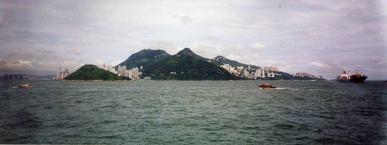
Entering the channel places swimmers into a view of the city usually reserved exclusively for passengers riding the public ferries across the water. Standing on the stone quay before the horn, the swirling currents and rolling surface chop can look intimidating from shore. Once immersed in the tide, however, the water feels entirely different, turning into an invigorating test of stamina and focus. Navigating across the harbour tests even seasoned competitors, because keeping a straight line in the moving seawater remains tricky despite advice to steer toward distant skyscrapers.
Victoria Harbour: granitic sound, deep currents, and returning marine life
Victoria Harbour covers an expanse of approximately 41.11 square kilometres, separating Hong Kong Island from Kowloon as a sheltered deep-water basin. Originally known as Hong Kong Harbour, the sound was later renamed in honour of Queen Victoria. The fairway was first charted in thorough hydrographic detail in an 1810 marine survey conducted by Daniel Ross and Philip Maughan. Along its southern shoreline, the historic settlement of Victoria grew through the 1890s along a 6.4-kilometre coastal strip bounded on the north by the water. That urban settlement was split into four administrative districts known as wans, encompassing coastal quarters such as Sai Wan and Ha Wan. To demarcate the boundaries of this waterfront city, the colonial administration erected stone boundary markers in 1903.
These boundary stones stand 98 centimetres tall with distinct tapered tops, and three newly discovered markers unearthed in 2021 brought the total number of preserved stones to ten. In 1972, the ocean liner RMS Queen Elizabeth caught fire and sank while anchored off Tsing Yi island. In another dramatic incident, China Airlines Flight 605 overshot the runway at Kai Tak Airport on November 4, 1993, coming to rest in the harbour waters. Today, the recovered water quality has made the return of the annual swimming race possible, alongside regular sightings of sea turtles and harbour porpoises surfacing in the channel.
Kellett Island: coastal batteries and the Noonday Gun
Kellett Island is a former rocky outpost that anchored early harbour defences. A small defensive fort was erected here in 1841 to guard the eastern approaches of Victoria Harbour. Engineers reinforced the position in 1854 with a dedicated coastal battery mounted with three cannons. After the British secured the Kowloon Peninsula in 1860, military authorities converted the island into a secure depot for ammunition and gunpowder storage. During the Japanese occupation beginning in 1941, the island remained a military storehouse, filled with artillery, ammunition, gunpowder, and fuel reserves. In 1939, the Royal Hong Kong Yacht Club constructed its permanent clubhouse directly upon the old naval powder magazine site on Kellett Island.
The sailing club had previously operated from a waterfront base in North Point for thirty years before moving to the island. Kellett Island remained surrounded by open water until a major land reclamation project connected it to Hong Kong Island in 1969. Along the waterfront near the former island stands the historic Noonday Gun. Coastline reclamation has shifted the foreshore steadily northward since the parcel was purchased in 1841. The original gun was dismantled and vanished during the Japanese occupation in 1941, but today a replacement Hotchkiss three-pounder that served in the Battle of Jutland fires every single day. At twelve o'clock, a guard rings a ship's bell to mark the end of the fore-noon watch, echoing traditions from when merchant warehouses lined East Point, before discharging a loud blast across the sea.
Causeway Bay Typhoon Shelter: typhoons and floating sanctuaries
East Point derived its original English name from a natural spit projecting into the bay, which backed onto a silted coastal fishing settlement. Modern walkers can still trace the original curve of that historic shoreline by following Tung Lo Wan Road. To safeguard fishing sampans from devastating tropical storms, the colonial authorities built the Causeway Bay Typhoon Shelter in 1883 with a 427-metre breakwater, making it the very first typhoon haven in Hong Kong. The shelter proved essential, particularly when a catastrophic typhoon struck the colony in 1906, destroying 3,653 vessels and claiming 15,000 lives. Following that calamity, engineers deepened the typhoon anchorage by three metres in 1908 and enlarged its surface area to 30 hectares.
In 1953, the refuge was relocated slightly seaward to its modern site, and the reclaimed ground of the original bay was converted into Victoria Park. Subsequent construction of the Cross-Harbour Tunnel during the late 1960s reduced the overall footprint of the typhoon basin. The shelter remains a colourful, active haven crowded with pleasure yachts, traditional wooden workboats, and houseboats moored side by side. The 'Walla-Walla' boats earned their name from the rhythmic thrumming sound of their propellers and electric engines churning through the sheltered tide.
Wan Chai waterfront: reclaimed piers, green promenades, and banyan trees
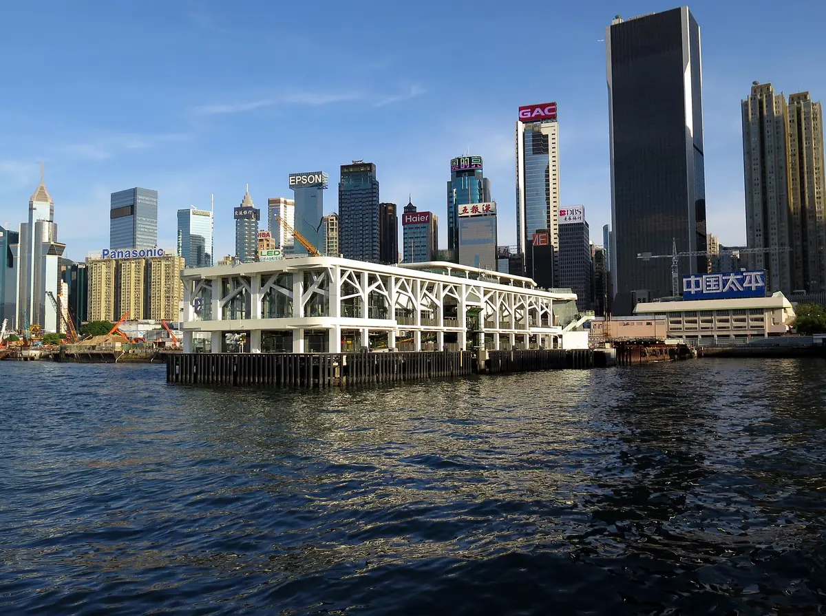
The original Wan Chai Pier was located along Gloucester Road near Tonnochy Road, with its first structure likely damaged during the Second World War. Between 1965 and 1972, major land reclamation pushed the shoreline north toward Convention Avenue and Hung Hing Road. A second pier served ferry commuters for 46 years before demolition made way for the Central–Wan Chai Bypass, leading to the third-generation terminal opened in 2014 across 2,200 square metres. Today, the redeveloped harbourfront invites spectators and competitors to relax right beside the water. The Wan Chai HarbourChill park features expansive synthetic grass lawns and whimsical heart-shaped photo arches set along the quayside. Preserved along the Causeway Bay embankment, a mature banyan tree stands near the former King Kee Shipyard, anchoring modern swimmers to the maritime craft that built this harbour.
Sources: Wan Chai Pier
Course
The race takes place in Victoria Harbour, starting from the Golden Bauhinia Square Public Pier in Wan Chai and finishing at the Tsim Sha Tsui Public Pier.
How to get there
New World Harbour Race
Frequently asked questions
- When is New World Harbour Race?
- New World Harbour Race takes place on November 15, 2026.
- What distances does New World Harbour Race offer?
- New World Harbour Race has a single distance: 1.6 km.
- How much is the entry fee for New World Harbour Race?
- The entry fee is 650 HKD. Prices for the 2026 edition (Victoria Harbour Race 2026). Application deadline was August 27, 2026; registration closed.
- Where does New World Harbour Race take place?
- New World Harbour Race is a sea swim. Location: Victoria Harbour, from Wan Chai (Golden Bauhinia Square Public Pier) to Tsim Sha Tsui Public Pier, Hong Kong.
- How do I register for New World Harbour Race?
- The reference page for registering for New World Harbour Race is http://www.hkharbourrace.com.
Where to stay
Accommodations in the Wan Chai and Tsim Sha Tsui districts range from high-end international chains to compact, efficient boutique hotels located near the harbor front. You will find many options within walking distance of the ferry piers. Expect to pay between $150 and $350 per night for a standard room, with prices fluctuating based on proximity to the water and the density of the surrounding commercial hubs.
Things to do nearby
The area is defined by its deep-water access and urban density. Between swims, you can explore the local markets or take a traditional junk boat tour to see the harbor from a different perspective. For those seeking land-based activity, the waterfront promenade offers extensive walking paths that track the perimeter of the bay, while the nearby hills provide challenging urban trekking trails that overlook the entire geography of the race course.
Swimmers
Similar races


Comments
Transparency: some links on this page (stays, flights, experiences, gear) are affiliate links — if you book or buy through them, Omniathlon may earn a commission from the partner at no extra cost to you. As an Amazon Associate we earn from qualifying purchases.