
Swim and SUP the Sound
- May 16, 2027
- Distances: 804m and 3.2km
At a glance
- Next edition date
- May 16, 2027
- Distances
- 804 m · 3.2 km
- Where
- Sea · Leverick Bay, North Sound, Virgin Gorda, British Virgin Islands
- Entry fee
- 100 USD
- Registration
- visar.org
About the race
Over three thousand acres of exceptionally calm Caribbean sea, enclosed by barrier reefs, form the natural basin of North Sound on Virgin Gorda. Swim and SUP the Sound is an open water swimming race held in the sea at Leverick Bay in North Sound, Virgin Gorda, in the British Virgin Islands. Swimmers gather at Leverick Bay to prepare, looking out across the sheltered water before stepping into the sea. The event offers two distinct open water swimming distances, featuring a shorter 804-meter course and a longer 3,218-meter distance designed for distance swimmers. Taking to the water here is both a sporting pursuit and a community tradition backed by local support.
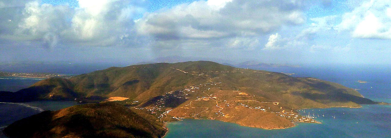
The competition is sponsored by Carey Olsen and is organized as an annual fundraiser for Virgin Islands Search and Rescue, known locally as VISAR. VISAR operates in these waters, and the event directly supports the volunteer teams that safeguard them. Setting off into the sound, competitors navigate with the reassurance of local safety cover while pursuing their target pace across the calm surface.
Starts, finish and the SUP race at North Sound
The 2024 starting points of Swim and SUP the Sound were a boat near Prickly Pear for the 1 Mile Swim, the beach at Bitter End Yacht Club for the 2 Mile Swim and the SUP race, and the fuel dock at Leverick Bay Marina for the Half Mile Swim. The 2023 race was set to run from the beach at Bitter End Yacht Club to a finish at Leverick Bay Marina. Besides the Half Mile, 1 Mile and 2 Mile swims, Swim and SUP the Sound includes a 2.5 mile stand-up paddleboard category. Swimmers can also race “assisted”, with mask, fins and snorkel, or in fancy dress. At Leverick Bay the races are followed by an afternoon of beach games and a barbecue.
North Sound and Eustatia Reef: calm waters and sea turtles
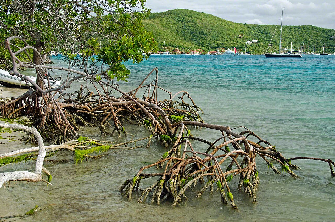
Trade winds in the region blow steadily from the east-northeast at an average of 10 to 15 knots, bringing a persistent warm breeze over the channel. Along the shoreline extending between Leverick Bay and Oil Nut Bay, thick formations of mangroves line the coast, stabilizing the intertidal zones with tangled roots that dip into the shallows. Past this mangrove-fringed shore lies Oil Nut Bay, a coral reef bay positioned on the northeast coast of Virgin Gorda. The bay is formally classified as a headland attached linear reef and features an expansive beach measuring approximately 0.80 kilometers in length. Southwest of Oil Nut Bay, the Yacht Club Costa Smeralda maintains a marina providing 38 slips capable of accommodating yachts measuring up to 91 meters in length.
Because the coral communities inside the bay remain susceptible to damage from boat anchors, preserving these fragile marine habitats requires continuous awareness and protection. Further east, the waters of Eustatia Sound remain protected by the extensive barrier of Eustatia Reef. In the surrounding waters of Eustatia Island, swimmers and snorkelers frequently encounter green, loggerhead, and hawksbill sea turtles foraging over the seabed. Southern stingrays and spotted stingrays also glide across the sandy bottoms of these waters, moving quietly along the bottom without disturbing swimmers.
Francis Drake and the maritime history of North Sound
Human settlement along the coasts of Virgin Gorda began millennia ago when the Taíno people arrived as the earliest known inhabitants, establishing settlements between 100 and 300 CE. Centuries later, European seafaring transformed the geographical crossroads of the Virgin Islands into waters frequented by buccaneers and pirates searching for shelter along trading routes. In 1585, the navigator Francis Drake anchored his fleet in the natural refuge of North Sound to stage his force before launching a raid against Santo Domingo. In 1595, a fleet of twenty-six ships gathered inside North Sound, utilizing the hill at Bitter End to drill naval maneuvers and practice artillery positions in preparation for an assault on San Juan.
Maritime commanders from the same era left lasting marks on regional place names, including the 17th-century Dutch squadron commander Jonathan de Neckere, whose name remains attached to Necker Island. In the modern era, the historical shipwrecks lying submerged around Virgin Gorda attracted marine archaeologist Bert Kilbride, who served as the territory's Receiver of Wreck and held ownership of the nearby outpost of Saba Rock.
Prickly Pear, Saba Rock and Eustatia Island across the bay
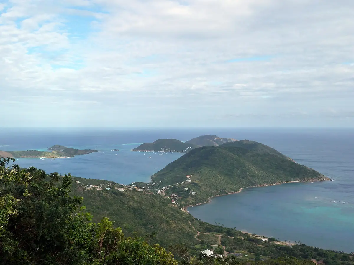
Enclosing the north side of the sound stands Prickly Pear, an uninhabited island facing Virgin Gorda across the sheltered bay. Designated as a national park in 1988, the island forms a tranquil environmental perimeter to the racing area. Its arid terrestrial landscape supports stands of agave and copperwood trees, creating a refuge for native reptiles including the Puerto Rican ameiva, the crested anole, the barred anole, and the big-scaled least gecko. Saba Rock is a tiny islet covering only about one and a half acres within the North Sound of Virgin Gorda. Saba Rock serves as a natural habitat for the crested anole lizard and sits directly adjacent to Eustatia Reef.
Despite suffering significant destruction during the passage of Hurricane Irma in 2017, the tiny rocky outpost remains an unmistakable landmark in the Sound. Eustatia Island has weathered severe tropical systems over recent decades, having been struck by Hurricane Earl in August 2010 and Hurricane Irma in September 2017. The island possesses three white sand beaches located along its south, north, and southwest shores. Backing the main beach is one of the largest mature coconut palm plantations in the British Virgin Islands, completing a quintessential tropical panorama seen from across the sound. On the western perimeter of Gorda Sound sits Moskito Island, situated near Virgin Gorda and Necker Island. Necker Island itself remained uninhabited until the late 20th century.
In 1965, two men attempted a castaway experiment there, but after spending 15 days on the island, they had to be evacuated due to a critical lack of fresh water. Later, on 22 August 2011, a lightning strike associated with Tropical Storm Irene ignited a fire that destroyed the island's Great House, and the island suffered total devastation when Category 5 Hurricane Irma struck on 6 September 2017.
The Baths of Virgin Gorda: granite boulders and tidal grottoes
After swimming in North Sound, a journey to the southern tip of the island leads to The Baths, situated between Spring Bay and Devil's Bay. Together with its adjoining bays, this unique shoreline has been protected as a British Virgin Islands National Park since 1990. The shoreline is distinguished by immense granite boulders that were formed by the slow cooling of underground magma and later laid bare by millennia of weathering and coastal erosion. These massive granite stones, the largest of which reach lengths of up to 40 feet or 12 meters, cluster directly on the sand and at the sea's margin. Their tumbled arrangement creates a labyrinth of natural tidal pools, secret tunnels, stone arches, and shadowed sea grottoes that open directly onto the turquoise water.
Wading and swimming through these stone galleries allows you to experience sunlight filtering through granite crevices straight into the clear sea. About thirteen kilometres south of the race area sits the uninhabited island of Fallen Jerusalem. The sanctuary was designated as a wildlife sanctuary in 1959, offering a protected habitat where the crested anole lizard thrives among the rocks. The island derives its evocative name from its enormous volcanic boulders, which lie scattered along the coast in shapes resembling the crumbling ruins of an ancient stone city. Whether swimming across the calm expanse of North Sound or exploring the sea caves of Virgin Gorda's granite coast, the island offers an open water setting shaped by rare geology and protected water.
Sources: Virgin Gorda · Necker Island (British Virgin Islands) · Oil Nut Bay · Eustatia Island · Mosquito Island · Saba Rock · Prickly Pear (British Virgin Islands)
Course
Previous editions
- 2026Jun 7, 2026
How to get there
Swim and SUP the Sound
Frequently asked questions
- When is Swim and SUP the Sound?
- Swim and SUP the Sound takes place on May 16, 2027.
- What distances does Swim and SUP the Sound offer?
- Swim and SUP the Sound offers 804 m and 3.2 km.
- How much is the entry fee for Swim and SUP the Sound?
- The entry fee is 100 USD. Entry fee is $100 for all competitors. Optional race t-shirt available for an additional $25 ($125 total).
- Where does Swim and SUP the Sound take place?
- Swim and SUP the Sound is a sea swim. Location: Leverick Bay, North Sound, Virgin Gorda, British Virgin Islands.
- How do I register for Swim and SUP the Sound?
- The reference page for registering for Swim and SUP the Sound is https://visar.org/swim-and-sup-the-sound.
Where to stay
Accommodations on Virgin Gorda range from upscale boutique hotels overlooking the harbor to modest seaside villas and family-run guest houses. For those preferring a proximity to the water, small-scale camping facilities are available near the beach areas. Prices typically fluctuate between $250 and $600 per night depending on the proximity to the North Sound and seasonal demand. Most lodgings are concentrated near the marinas, providing easy access to the race start at Leverick Bay.
Things to do nearby
Beyond the race, the North Sound is a hub for active exploration. You can rent kayaks or stand-up paddleboards to navigate the intricate reef channels or join guided snorkeling tours to explore the submerged rock formations. The island offers extensive trails for trekking through the interior, leading to viewpoints that overlook the entire archipelago. Additionally, local businesses organize weekend culinary tours that focus on Caribbean flavors and fresh seafood, providing a tangible link to the island's long history as a coastal settlement.
Swimmers
Similar races


Comments
Transparency: some links on this page (stays, flights, experiences, gear) are affiliate links — if you book or buy through them, Omniathlon may earn a commission from the partner at no extra cost to you. As an Amazon Associate we earn from qualifying purchases.