
Swim GP - Travessia Lisboa-Cascais
- Jul 24, 2027
- Distance: 20km
At a glance
- Next edition date
- July 24, 2027
- Distances
- 20 km
- Where
- Sea · Lisbon to Cascais, Lisboa, Portugal
- Registration
- swimgp.com
About the race
From the tidal waters of Belém Dock, the outward flow of the Tagus estuary provides long-distance swimmers with a sustained oceanward carry toward the Atlantic. The Swim GP - Travessia Lisboa-Cascais is a 20-kilometre open water marathon race connecting Lisbon to the coastal bay of Cascais in Portugal. The morning begins along the Lisbon riverfront with an opening ceremony beside the Padrão dos Descobrimentos, where the Portuguese national anthem and the open water swimming anthem sound across the quay. Swimmers enter the water at Belém Dock to undertake a continuous 20-kilometre course structured into two distinct hydrodynamic phases: an opening nine-kilometre descent along the Tagus River, followed by eleven kilometres along the open Atlantic coastline.
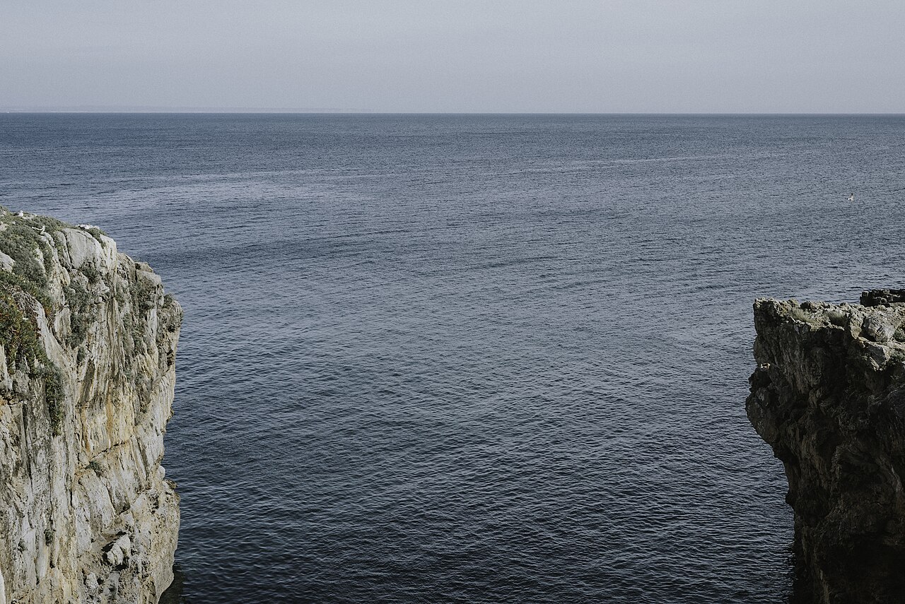
Slipping into the brackish current, you immediately feel the pull of the outgoing river speeding each stroke toward the open sea. Safety regulations require every participant to swim alongside a dedicated escort kayak, turning the individual marathon into a closely coordinated team effort for pacing, route monitoring, and regular feed stops. Conducted under World Aquatics rules, the race enforces an eight-hour cut-off time and caps participation at 65 competitors to ensure close logistical and maritime oversight. While adverse weather can intervene—a past edition had to be called off when heavy morning fog blanketed the estuary, and the 2020 race was cancelled during the global pandemic—the close presence of your kayaker provides reassurance and steady directional focus in wide open water.
The competition revives the heritage of a historic 1906 Lisbon-to-Cascais race made famous by swimmer Arthur Rumsey. In 2012, Jorge Paulo Pereira re-established the crossing under the banner of the Swim Challenge Cascais, creating Portugal's first open water swimming event organized by an independent private entity. Today organized by Swim GP, the crossing finishes at Praia dos Pescadores in Cascais, where swimmers emerge onto the town beach after navigating out of the river mouth into the open ocean. Swimmers seeking a shorter companion test on the same day can also look to the Swim GP - Travessia Oeiras-Cascais, which covers eight kilometres along the outer stretch of the coast.
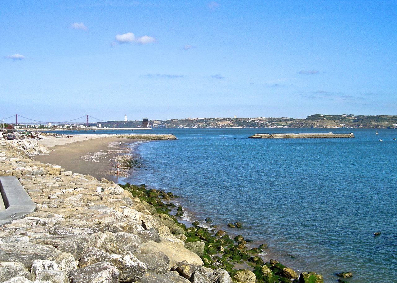
Tagus River mouth: tidal flow and sandbanks
The initial stage of the race is governed by powerful hydrological forces as the river drains into the sea. Tide flow speeds inside the Tagus estuary regularly exceed 1.5 metres per second and can surge up to 2.5 metres per second on the falling tide, providing swimmers with a substantial natural boost during the opening nine kilometres. Sighting off the support kayak helps swimmers remain centred within the fastest outgoing channels as the banks slip away on either side. About seven kilometres upriver from the race area, the vast Tagus channel is spanned by the 25 de Abril Bridge, which links Lisbon on the northern shore to Almada on the south bank.
Built over a region known for historic seismic activity, the suspension bridge carries an upper vehicular deck 70 metres above the water line and is anchored on the south side beside the monumental Christ the King statue. The bridge's massive south pillar extends to a depth of 79.3 metres below water level, an engineering feat that made it the deepest bridge foundation in the world when it was finished. Further downstream toward the bar, about five kilometres from the race course, maritime silting created an isolated sandbank that represents the only patch of land in that sector remaining above the water level throughout every tidal cycle. Built upon these sands sits the Forte de São Lourenço do Bugio, an offshore fortress designed by architect Giovanni Casale with an unusual circular layout specifically engineered to deflect the violent scouring of estuary currents and heavy ocean swells.
Managing these shifting river channels has occupied navigators for centuries: formal depth surveys were commissioned in 1607 and 1608 to preserve deep-water access for heavily laden fleets returning from India, followed in the 1930s and 1940s by extensive dredging programmes around the sandbank.
Belém to São Bruno: seventeenth-century estuary defenses
The shoreline along the northern bank preserves a dense network of coastal fortifications raised to guard the maritime gateway into the capital. About four kilometres from the race area stands Belém Tower, constructed from local lioz limestone on an islet in the river before urban expansion and shoreline reclamation gradually incorporated the structure into the mainland. The tower originally served as an armed customs post where inbound trading ships had to pay mandatory duties to enter the port, and between 1828 and 1834 its subterranean vaults were used to incarcerate liberal opponents of King Miguel I. A navigational beacon and an optical telegraph station were later added to its southeast terrace in the 1860s.
About one kilometre from the race area, the shoreline features the Fort of São Bruno, built in 1647 upon a rocky promontory in the Tagus estuary. São Bruno belonged to a coordinated coastal defense cordon that ran uninterrupted from Cabo da Roca all the way to Belém Tower. The fort proved remarkably resilient, surviving the catastrophic 1755 Lisbon earthquake with very limited damage and remaining fully operational with sixteen cannon during the Spanish-Portuguese War of 1762–1763. Yet the moving sands of the estuary constantly challenged the garrison, as a formal military inspection in 1735 noted that one of its lower gun batteries had already been entirely buried by sand drifts.
About two kilometres from the race area, on the right bank of the estuary, sits the sister fortification of Fort of Giribita. Completed in 1649 on a projecting rocky outcrop over the foundations of an earlier battery, it was engineered to cross defensive artillery fire with São Bruno. Like São Bruno, it formed an integral part of the defensive line stretching toward Belém Tower, later transitioning into industrial military logistics when it was converted into a storage facility for naval torpedo equipment starting in 1877.
São Julião and the Tagus bar lighthouses
Navigating past the inner estuary brings swimmers toward the open entrance of the river bar. About six kilometres from the race area, on a headland commanding the north bank of the Tagus estuary, stands the irregular pentagonal stronghold of São Julião da Barra. Rising from this headland is the 24-metre São Julião Lighthouse, elevated at an altitude of 39 metres above the waves. A warning beacon has operated on this point since at least 1553, though the early tower collapsed during the 1755 Lisbon earthquake, prompting the construction of a stone lantern in 1761 and the installation of a fourth-order Fresnel lens between 1848 and 1865. Across the mouth of the estuary, the lighthouse on the Bugio sandbank was also destroyed by the 1755 earthquake and had to be rebuilt in 1775.
In 1831, Bugio came under fire during the passage of the Tagus bar when a French naval squadron commanded by Admiral Roussin forced its way into the river under heavy cannon fire. That same year, King Miguel I conducted target practice with São Bruno's coastal artillery, firing live rounds at transport barges anchored on the Tagus.
Gibalta and Dafundo: the waterfront towards Cascais
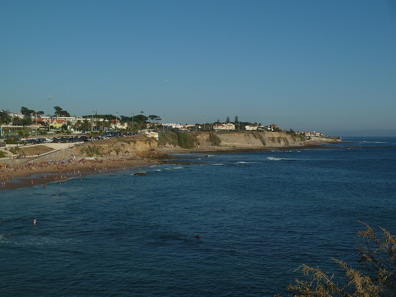
Under one kilometre from the race area, navigation into Lisbon is marked by the Gibalta Lighthouse, where guiding beacons were first constructed between 1878 and 1879. A fatal train derailment and landslide swept away the historic tower in 1952, leading to the construction of the modern replacement that has been active since February 1954. The present cylindrical tower rises 21 metres in height and stands 30 metres above sea level. When the scenic coastal motorway linking Lisbon and Cascais was built along the waterfront below, four red fluorescent lamps were mounted to the tower structure to prevent vehicle headlights and highway glare from obscuring the beacon for vessels out at sea. Right along this stretch of coast lies Praia do Dafundo, a 480-metre shoreline with a gentle sandy slope bordered by a low strip of sand dunes. The beach is divided cleanly down the centre by the mouth of the Ribeira da Junça stream as it empties into the estuary.
Course
Point-to-point race starting at Belém Dock (Lisbon) in the Tagus River, following the ebb tide for 9km into the ocean, then 11km in the ocean to finish at Pescadores Beach (Cascais). Requires support kayak for safety and nutrition.
Awards
Flower ceremony at 1:00 pm and Team Award Ceremony at 1:15 pm at Pescadores Beach.
Aid stations
- Aid stations
- 4
4 aid stations provided to feed the swimmers' support kayaks.
Useful info
Aquatic ultramarathon event considered one of the most popular in Europe. Registration and technical details are available on the official website swimgp.com or via the timing platform lap2go.com. The races take place in various distance categories.
How to get there
Lisbon Airport (LIS) is 25km away. Cascais train station can be reached from Cais do Sodré (Lisbon) in 40 min. The site is accessible by train (Cascais line) or by car via the N6 (Avenida Marginal). Parking is available at the Cascais Marina and surrounding areas; the use of public transport is recommended due to heavy traffic.
Swim GP - Travessia Lisboa-Cascais
Frequently asked questions
- When is Swim GP - Travessia Lisboa-Cascais?
- Swim GP - Travessia Lisboa-Cascais takes place on July 24, 2027.
- What distances does Swim GP - Travessia Lisboa-Cascais offer?
- Swim GP - Travessia Lisboa-Cascais has a single distance: 20 km.
- Where does Swim GP - Travessia Lisboa-Cascais take place?
- Swim GP - Travessia Lisboa-Cascais is a sea swim. Location: Lisbon to Cascais, Lisboa, Portugal.
- How do I register for Swim GP - Travessia Lisboa-Cascais?
- The reference page for registering for Swim GP - Travessia Lisboa-Cascais is https://swimgp.com/provas/travessia-lisboa-cascais-20km/.
Where to stay
Lisbon offers a mix of historic boutique hotels near the Belém district and modern apartments along the Cascais coastline. For those preferring a local atmosphere, traditional guesthouses in the narrow streets of Cascais provide easy access to the finish line. Expect to pay between €120 and €250 per night for a double room, depending on proximity to the water and the level of service. Camping options are available further along the Estoril coast, typically ranging from €30 to €60 per pitch.
Things to do nearby
The weekend provides opportunities to explore the region’s maritime heritage beyond the race. You can book kayak or SUP excursions to get a closer look at the coastal forts from the water, or tour the UNESCO-listed monuments in Belém. Local gastronomy focuses on fresh Atlantic seafood, with numerous tasting sessions available in the harbor towns. For a change of pace, the coastal trails between Cascais and Cabo da Roca offer extensive trekking paths with panoramic views over the cliffs.
Swimmers
What to see around
1. Boca do Inferno (iconic rock formation). 2. Cabo da Roca (westernmost point of Europe). 3. Sintra-Cascais Natural Park (trekking and trail). 4. Cascais historic center and beaches (surfing and swimming). 5. Pena National Palace in Sintra (UNESCO heritage site 15km away).
Similar races


Comments
Transparency: some links on this page (stays, flights, experiences, gear) are affiliate links — if you book or buy through them, Omniathlon may earn a commission from the partner at no extra cost to you. As an Amazon Associate we earn from qualifying purchases.