
COPA MARNATON eDreams
- Oct 10, 2026
- Last edition date
- Distances from 2km to 8km
At a glance
- Last edition date
- October 10, 2026
- Distances
- 2 km · 4 km · 8 km
- Where
- Sea · Ibiza, Islas Baleares, Spain
- Entry fee
- 45–75 €
- Registration
- rockthesport.com
About the race
Organized by MARNATON, the MARNATON eDreams Ibiza by Baleària serves as the final stop of the Copa MARNATON eDreams national open water swimming circuit. Swimmers gather on the island in October to round out the racing season along one of the most untouched coastal stretches in the archipelago. The event offers three distinct point-to-point courses tailored to different endurance levels, all converging on the same sandy finish line at Port de Sant Miquel. The longest challenge spans 8,000 meters, taking swimmers from the bay of Cala Xarraca across open coastal waters to the port. A mid-distance course covers 4,000 meters beginning at Es Caló d'en Calders, while a 2,000-meter sprint sets off from the sheltered waters of Cala Benirràs.
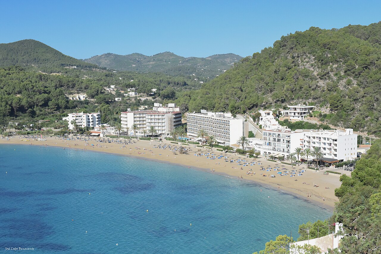
Out on the course, the sea reveals the wilder character of northern Ibiza, where clear turquoise waters provide exceptional visibility over untamed seabeds. Even when offshore breezes kick up a slight chop across the surface, swimmers can look straight down through the brine to watch the rocky contours below. Reaching the sheltered beach at Port de Sant Miquel brings immediate relief, leading straight into the celebratory Splash & Blast Sunset Party held at the Cala San Miguel Resort right by the shore.
North Ibiza: Port de Sant Miquel, Benirràs and past editions
Port de Sant Miquel, also known as Port de Balansat, has a beach of coarse-grained sand about 100 metres long, 3.5 km from Sant Miquel. Port de Sant Miquel was once where smugglers hid their goods in caves such as the En Marçà cave, which can now be visited on guided tours. Cala Benirràs is a coarse-sand beach about 132 metres long and 30 metres wide, at the foot of the Puig des Guixar, which is 189 metres high. In front of Cala Benirràs stands the rock island of Es Cap Bernat, almost 30 metres high, and fishing shelters line the shore. At the first MARNATON eDreams Ibiza by Baleària about 250 swimmers covered 12 km, 6 km and 1.5 km, starting at Port de Sant Miquel and finishing at Portinatx beach. At the 2026 edition the organisers described the sea as somewhat choppy but with good visibility.
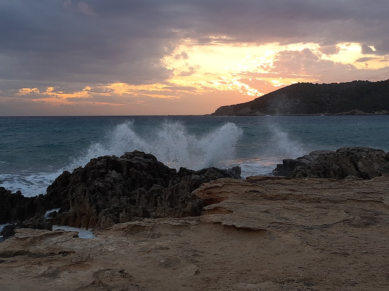
The Pitiusas sea: pine-covered cliffs, mild temperatures and water clarity
Ibiza and its neighboring island Formentera form the Pitiusas archipelago, an ancient name inspired by the dense woodlands of three different pine species. The surrounding Mediterranean plays a defining role in shaping the local climate, moderating air extremes and keeping freezes and severe weather exceptionally rare throughout the year. Thanks to this maritime buffer, the sea remains pleasantly mild well into autumn, offering welcoming conditions for endurance swimming long after continental waters have chilled. The Santa Eulalia river represents the only true river in the Balearic Islands, yet it has remained dry for many years due to the overexploitation of local aquifers.
Sa Caleta and Puig des Molins: Phoenician bays and ancient shores
Human communities established settlements across Ibiza and Formentera between 2000 and 1600 BC. Centuries later, around the middle of the 7th century BC, Phoenician traders arrived on the island and established the settlement of Sa Caleta on the southwest coast. Sa Caleta occupies a distinct horseshoe-shaped bay that provided an ideal natural harbor for early sailors looking to moor their vessels out of reach of heavy waves. Today, exploring these ancient shorelines offers swimmers a direct window into millennia of seafaring heritage.
Playa d'en Bossa to Botafoc: watchtowers and historic navigation lights
Along the east-facing shore lies Playa d'en Bossa, a vast beach running for 2.7 kilometers with natural fine white sand that spans between 20 and 30 meters in width. The bay is exposed to winds blowing straight from the sea toward the land, creating a wide marine playground over a shallow, gently sloping seabed. The water here deepens very gradually, measuring just half a meter deep at 25 meters from shore and only one meter deep at 50 meters out. At Playa d'en Bossa stands the Torre de la Sal Rossa, a remarkably well-preserved stone defensive tower. Further around the bay, navigation has long been anchored by the historic islet of Botafoc, about three kilometers away, where islanders once lit bonfires to guide mariners entering the harbor.
Construction of the permanent Faro de Botafoc began in October 1859, and the beacon was officially inaugurated in November 1861. Because the rocky islet offered scarce building ground, the lighthouse keepers' quarters were designed vertically across two floors to make use of the limited space. The beacon was modernized with electricity in 1918 and continues to flash on a seven-second cycle, alternating between white and red beams depending on the sector. Its red light sector specifically alerts approaching vessels and night navigators to the treacherous underwater contours of the Malvins and Esponja islets.
Platja S'Estanyol and Talamanca: fishermen boathouses and sea caves
Swimmers scouting calmer training waters or looking for recovery swims after the races at Port de Sant Miquel will find sheltered havens tucked into the island's indented coast. The bay of Talamanca curves into a shallow, protected inlet of natural fine sand that remains largely buffered from rough winds. Facing southeast, dominant sea breezes push gently toward the land over a bottom that transitions from soft sand and submerged marine vegetation to deeper rock formations. Tucked further along the coastline is the secluded inlet of Platja S'Estanyol, oriented toward the east and deeply sheltered from the prevailing coastal winds. The cove is framed on one flank by flat stone platforms where swimmers can slip effortlessly into the calm, transparent water.
Along the northeastern edge of the cove stand rustic wooden boathouses built by local fishermen, lending the shoreline a timeless maritime atmosphere. Beneath the surface, the rocky perimeter hides underwater caves that draw snorkelers and swimmers to explore its submerged crevices before leaving the island.
Sources: Ibiza · Ibiza (city)
Course
How to get there
COPA MARNATON eDreams
Frequently asked questions
- When was the last edition of COPA MARNATON eDreams?
- The last edition of COPA MARNATON eDreams took place on October 10, 2026.
- What distances does COPA MARNATON eDreams offer?
- COPA MARNATON eDreams offers 2 km, 4 km, and 8 km.
- How much is the entry fee for COPA MARNATON eDreams?
- The entry fee ranges from 45 € to 75 €. Prices are indicative and subject to change based on the registration calendar phases.
- Where does COPA MARNATON eDreams take place?
- COPA MARNATON eDreams is a sea swim. Location: Ibiza, Islas Baleares, Spain.
- How do I register for COPA MARNATON eDreams?
- The reference page for registering for COPA MARNATON eDreams is https://www.rockthesport.com/es/evento/xv-copa-marnaton-edreams-.
Where to stay
Ibiza offers a range of options, from traditional white-washed houses in the countryside to boutique hotels overlooking the Dalt Vila harbor. Budget-conscious participants often prefer the camping sites located near the northern beaches or standard apartments in Ibiza Town. Prices typically range from 90 EUR per night for simple guesthouses to over 250 EUR for upscale coastal resorts during the autumn season. Booking in advance is recommended due to the island's popularity with endurance athletes.
Things to do nearby
Beyond the water, the island provides diverse activities for the weekend. Visitors can explore the Puig des Molins necropolis for a deep dive into Punic archaeology, or join guided kayak expeditions to explore the rocky coves near Sa Caleta. The island's interior offers extensive trekking routes leading up to the summit of Sa Talaiassa, providing panoramic views of the entire archipelago. Local culinary traditions are best experienced through wine and olive oil tastings in the rural villages of the interior.
Swimmers
Other races by this organiser
- Marnaton FormenteraFormentera, ES
- Marnaton SitgesSitges, ES
- Marnaton BegurBegur, ES
- Marnaton Sant FeliuSant Feliu de Guíxols, ES
- Marnaton CadaquésCadaqués, ES
Similar races


Comments
Transparency: some links on this page (stays, flights, experiences, gear) are affiliate links — if you book or buy through them, Omniathlon may earn a commission from the partner at no extra cost to you. As an Amazon Associate we earn from qualifying purchases.