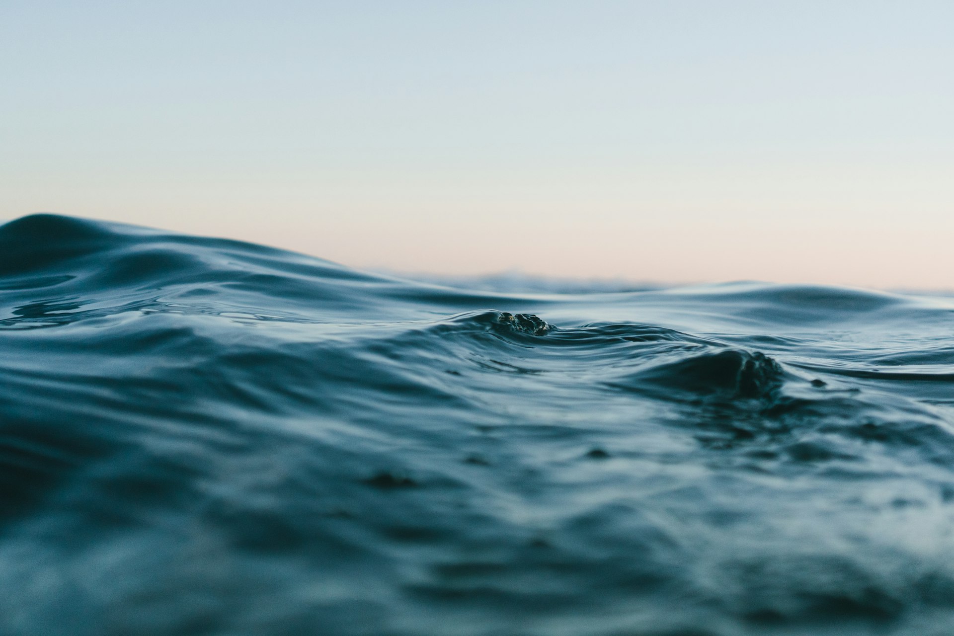
Copa Nadar es Vida — Chorrillos
- Nov 29, 2026
At a glance
- Next edition date
- November 29, 2026
- Where
- Sea · Lima, Chorrillos, Peru
About the race
Along the Pacific Ocean in the district of Chorrillos, open water swimmers gather on the sand of Playa Agua Dulce. The Copa Nadar es Vida is an open water swimming race held in the sea off Chorrillos, in the province of Lima, Peru. Organized through Club Nadar es Vida, the competition was established to promote open water swimming as a healthy, recreational, and competitive lifestyle. The late November date places the event right at the transition into the southern hemisphere's warmer coastal season. At Playa Agua Dulce, the average sea temperature during the event ranges from 18°C (64 °F) to 20°C (68 °F), providing refreshing conditions that remain manageable without extreme cold. While the beach is recognized along this urban coast for its generally calm waters, the Pacific Ocean can still challenge participants.
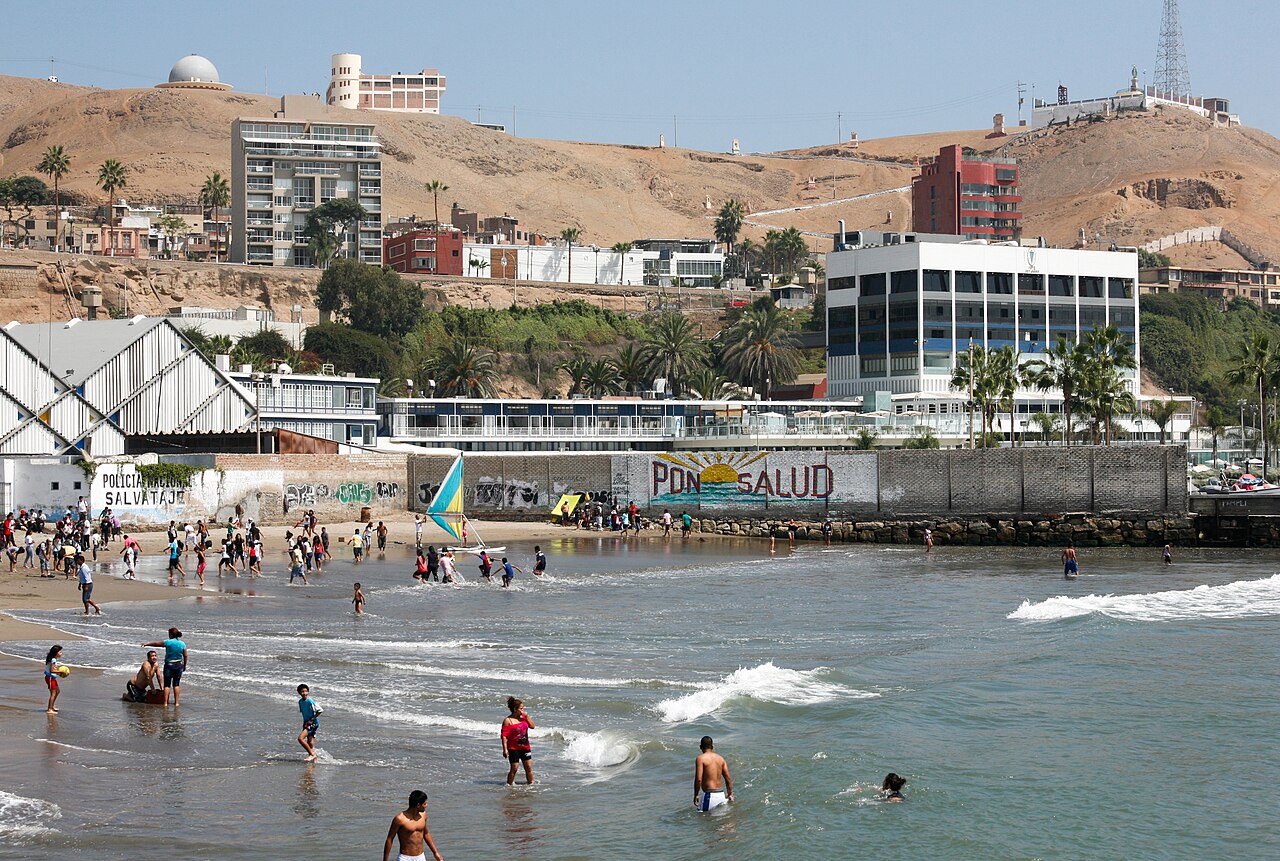
In past editions, rough sea conditions made the swimming experience particularly demanding and enriching as competitors pushed through the choppy surface. That direct, physical dialogue with the ocean defines every stroke of the event; a visually impaired swimmer described her swim as a strange yet beautiful encounter, guided by the rhythm and sensation of the cold Pacific waves rolling beneath her.
Morro Solar and the geology of Chorrillos Bay
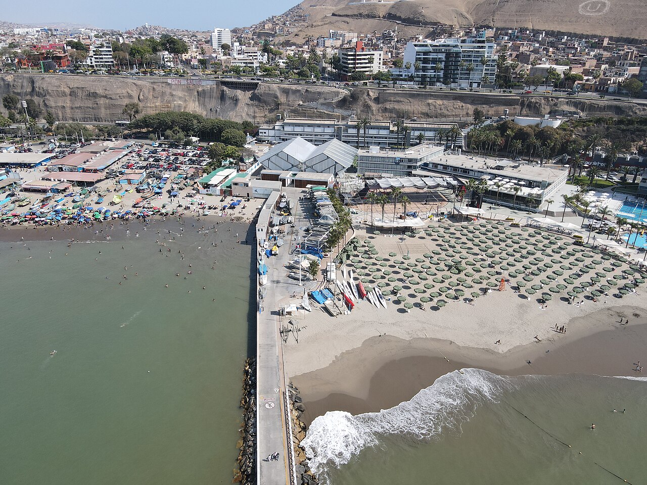
Standing prominently along the ocean shoreline is Morro Solar, a headland that reaches an elevation of approximately 251 meters. The seaward face of this towering promontory drops precipitously, terminating in a steep cliff directly above the breaking surf. Continuing past the headland toward Lurin, the coastline transitions into the sandy shore known as Conchan Beach. The seabed of Chorrillos Bay is composed of hard sand, clay stones, and boulders, a combination that historically caused mariners to avoid anchoring their ships in these waters. On shore, the distinctive geography of the Chorrillos district provides an open vantage point over the wider Bay of Lima, looking out toward the peninsula of La Punta and the offshore silhouette of San Lorenzo Island.
The cliff springs of Agua Dulce and Las Sombrillas
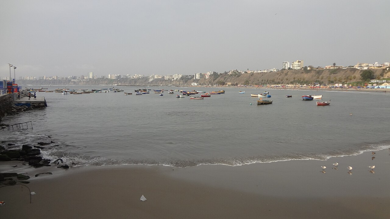
The district of Chorrillos forms an integral part of the scenic Costa Verde area that lines the Pacific shore. Just north along the waterfront, situated between Agua Dulce beach to the south and Los Yuyos beach to the north, lies Playa Las Sombrillas. Las Sombrillas holds a unique ecological position as the only beach in the entire Costa Verde circuit that preserves natural wetlands and reed beds. These reed beds and fragile coastal wetlands are directly fed by fresh water falling down the face of the cliffs.
Armatambo and ancient Pacific ocean veneration
Directly adjacent to the Pacific Ocean, at the foot of Morro Solar, lie the archaeological remains of Armatambo. Before the arrival of Europeans, the area around the headland housed this thriving pre-Columbian town, which served as a coastal administrative center and an essential resting place on the pilgrimage trail to the sanctuary of Pachacámac. In the late nineteenth century, archaeologist Adolph Bandelier documented the complex, noting that it had already suffered heavy deterioration from past earthquakes and colonial looting. Bandelier's detailed plans recorded small settlements at the eastern boundary, a large building complex toward Chorrillos, an ancient cemetery, and a cluster of dwellings near the summit of Morro Solar. In 2021, the Ministry of Culture removed 50 illegal houses built on Morro Solar, where unauthorized construction had altered the archaeological terrain by leveling surfaces to build stone terraces and access paths.
Because the archaeological site directly borders the sea, it also suffers from ongoing soil contamination tied to residential sprawl and local livestock activities. About seven kilometres away from the race area stands the ancient ceremonial complex of Huaca Pucllana, originally irrigated by a branch of the Surco canal less than two kilometers from the Pacific cliffs. Constructed between 200 and 700 AD by the Lima culture, the site was built using a distinctive earthquake-resistant technique called 'librero', where rectangular adobes were placed vertically like books on a shelf to dissipate seismic vibrations. The ancient inhabitants of Pucllana were farmers and fishermen whose daily diet relied primarily on marine foods alongside cultivated crops like corn, beans, and maca.
The Lima culture held deep spiritual reverence for the sea, depicting fish, sea lions, eels, and sharks across their ritual ceramics. Within this ocean cosmology, the shark was venerated as a sacred sea divinity, playing a central role in ritual offerings, funerary textiles, and ceremonial banquets that celebrated the bounty of the Pacific.
Nineteenth-century coastal battles at Chorrillos
The coastal hills surrounding Chorrillos carry a profound military memory from the nineteenth-century War of the Pacific. On 22 December 1880, the Chilean army conducted a massive sea disembarkment at Curayaco, roughly seven kilometres away, initiating their march toward the capital. To defend the approaches to Lima, Peruvian forces established fortified artillery emplacements across the terrain, fortifying Marcavilca hill, La Chira, Santa Teresa, and Villa. When the fighting reached the settlement during the battle in 1881, the town of Chorrillos was set on fire by the attacking Chilean army to force its capture, leading to the destruction of the historic district. These dramatic events deeply marked the local memory, leaving an enduring historical heritage along the coastal bluffs above the ocean.
The Chorrillos seafront and the artisanal fishing cove
Chorrillos has preserved the maritime character that first defined it as an early settlement for traditional fishermen. Right alongside the calm waters of Playa Agua Dulce, the artisanal fishing pier remains an active cultural landmark where visitors can watch local fishermen landing their daily catch or hire traditional small boats for trips across the bay. Along the clifftops above, the Malecón de Chorrillos offers a 10-kilometer coastal promenade complete with landscaped parks, fountains, and sweeping views of the Pacific Ocean. Further along the Miraflores district boardwalk, the Malecón de la Reserva stretches from the Villena bridge down to the Armendaríz descent, offering elevated panoramas over the Costa Verde coastline. Along this coastal highway, on the rocky jetty number 4, sits the historic restaurant La Rosa Náutica, built directly on a pier extending out over the water.
Further along the beach circuit, Playa La Pampilla covers 350 meters of pebble stones where wave breaks reach up to two meters in height. Playa La Herradura is historically famous for powerful waves that can reach heights of up to four meters. Originally a sandy beach, road construction in the 1980s covered the shore with stones, and dynamite blasting in 1983 damaged the surrounding cliff, the seabed, and the local marine ecosystem. Despite these disruptions, the beach was inscribed into Peru's National Reef Registry in 2016 to safeguard its world-renowned surfing breaks. Today, a lively seafront promenade of restaurants and bars lines the cove, looking out toward the spot where the oil tanker Caplina ran aground just 120 metres off the beach in 1963.
Between 2010 and 2014, a local dolphinarium even housed two bottlenose dolphins right along this historic shore. From the peaceful sandy shallows of Agua Dulce to the ocean, this storied Peruvian coast offers open water swimmers an unforgettable arena shaped by living maritime tradition and the raw power of the Pacific.
Sources: Armatambo · Playa Las Sombrillas · Chorrillos District · Morro Solar · La Herradura, Lima
Course
How to get there
Copa Nadar es Vida — Chorrillos
Frequently asked questions
- When is Copa Nadar es Vida — Chorrillos?
- Copa Nadar es Vida — Chorrillos takes place on November 29, 2026.
- Where does Copa Nadar es Vida — Chorrillos take place?
- Copa Nadar es Vida — Chorrillos is a sea swim. Location: Lima, Chorrillos, Peru.
Where to stay
Chorrillos offers a mix of modest family-run guesthouses and functional apartments catering to those seeking proximity to the water. In the adjacent district of Barranco, you can find boutique hotels housed in restored colonial-era villas that overlook the sea. Prices for a double room typically range from $60 to $150 per night, depending on the level of amenities and distance from the coast. Find a place to stay near the race start.
Things to do nearby
The weekend provides opportunities to explore the local maritime culture, ranging from tasting traditional ceviche at the historic fish markets of the Chorrillos harbor to visiting the nearby archaeological huacas. For those interested in active recovery, the cliffs of the Costa Verde offer routes for morning runs, while the waters around the headland are frequently used for kayak and SUP sessions. Discover activities for your race weekend.
Swimmers
Similar races


Comments
Transparency: some links on this page (stays, flights, experiences, gear) are affiliate links — if you book or buy through them, Omniathlon may earn a commission from the partner at no extra cost to you. As an Amazon Associate we earn from qualifying purchases.