
Descente du Richelieu
- Jun 7, 2026
- Last edition date
- Distance: 2km
At a glance
- Last edition date
- June 7, 2026
- Distances
- 2 km
- Where
- River · Rivière Richelieu, Richelieu, Quebec, Canada
- Entry fee
- 30 CAD
- Registration
- clubobc.com
About the race
The Descente du Richelieu is an open water swimming race held in the waters of the Richelieu River at Richelieu in Quebec, Canada. The open water swimming course covers a distance of 2,000 metres down the river. Swimmers enter the water at the Saint-Mathias Marina and follow the course downriver to the rowing club. The swim was established as a dedicated open water category to offer athletes an opportunity to push their limits while showcasing their technical skill in the river. What distinguishes this descent is the natural pull of the Richelieu River, which makes the swim fast and accessible. Swimmers follow the river's current, allowing the moving water to assist their stroke from start to finish.
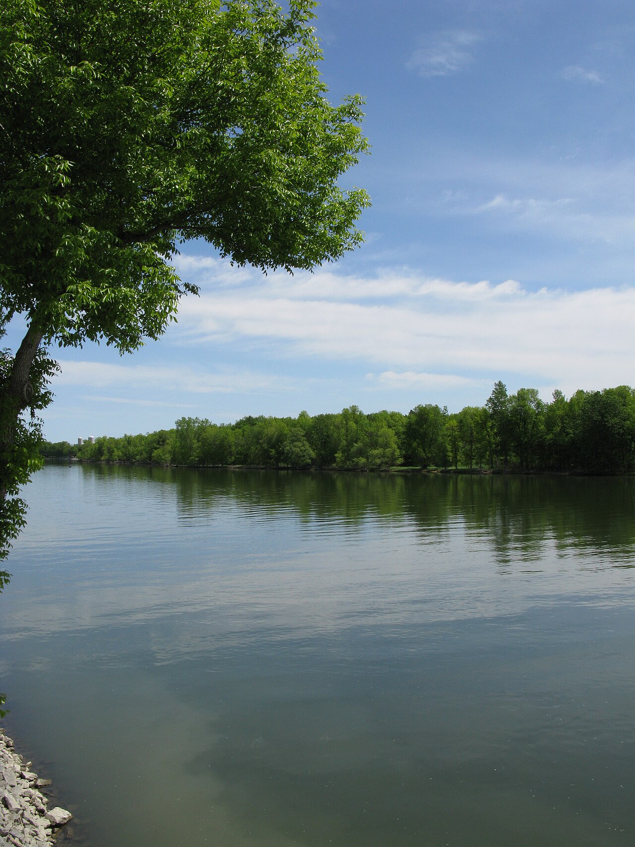
For anyone feeling tired during the swim, the steady downstream flow allows participants to pause and simply drift along the course while catching their breath. The event shares the water with broader non-motorized descents, including a 12-kilometre course from the Chambly Basin designed to demonstrate that the river is open and accessible to everyone.
From Lake Champlain to the St. Lawrence: the Masoliantekw waters
The Richelieu River flows for 124 kilometres, traveling north from Lake Champlain all the way to the Saint Lawrence River. Long before modern swimmers entered its current, the Indigenous Abenaki knew this river as Masoliantekw, meaning "water where there is plenty of food." The waterway also serves as an important north-south migration corridor for wildlife, welcoming thousands of geese and ducks that arrive along the river every autumn. Before opening into the wider section, the Richelieu surges through 1.35 kilometres of rapids. These waters empty into the Chambly Basin, an oblong and shallow body of water created by the natural widening of the river. In winter, the entire surface of the basin freezes solid, remaining covered in ice from mid-December until the end of March.
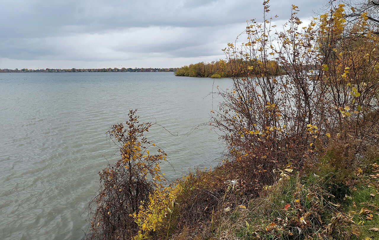
By June, however, the thaw gives way to open waters that welcome swimmers and paddlers back to the river. The river corridor has also seen dramatic moments in transportation history. Today, the river has returned to a tranquil rhythm, offering open space for recreation and community events on the water.
The island archipelago of the Chambly Basin
When Samuel de Champlain explored the basin in 1609, he described it as a lake-like area opening right at the entrance of the rapids. Along the southeastern shore of the basin lies an archipelago of small river islands. The western section of the basin contains several notable islands, including Île aux Lièvres, Demers Island, Île au Foin, and Goyer Island. Demers Island is a river island measuring 1.2 kilometres in length and 0.36 kilometres across, ranking as the third largest of the four islands separating the Chambly Basin from the Acadia River. Private wharves line its western shoreline on the basin, while a strip of land on its northeast side connects it to Hay Island.
Narrow canals flanked by marshland border Demers Island, creating calm wetland margins along the water. At the confluence where the Acadia River meets the Richelieu sits Goyer Island. This island features marsh areas along the Acadia River and is separated from Lièvres and Hay islands by a natural channel. These lush islands and wetlands form a scenic backdrop for swimmers navigating the broad river course.
Fort Chambly and the seventeenth-century frontier forts
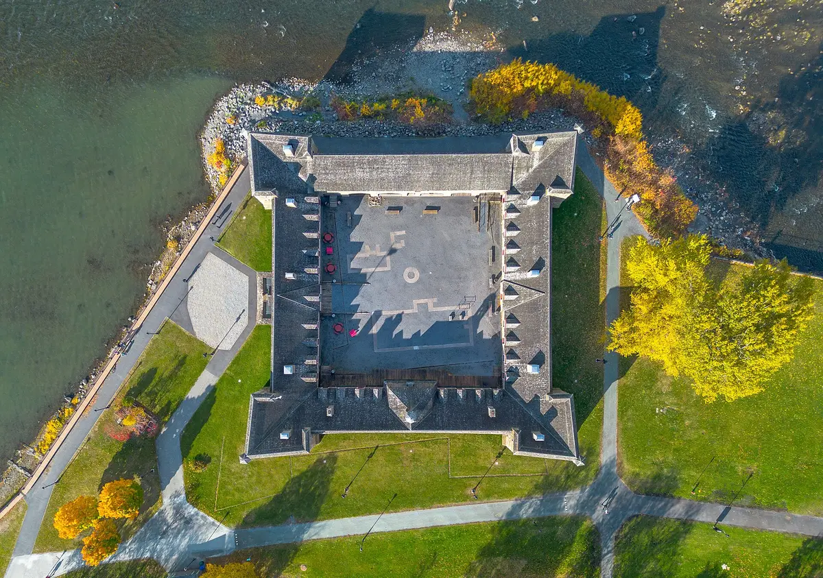
For generations, the Richelieu River formed a strategic military corridor defended by five French-built forts, including Fort Richelieu and Fort Chambly. Located about three kilometres from the race area, Fort Chambly stands at the foot of the river rapids. In 1709, authorities ordered the construction of a stone fortress designed to withstand European artillery fire. Five miles south of Fort Chambly, at the upper end of the rapids, stood the stockaded post and village of Sainte-Thérèse, situated about five kilometres from the race area. This contested borderland saw military clashes, including an engagement on June 6, 1760, on the Pointe Au Fer Peninsula on the shore of Kings Bay, fought between a bog on the right and the lake shore on the left.
During the 1775 siege, Fort Saint-Jean was ringed by a ditch seven feet wide and eight feet deep lined with chevaux de frise, while its eastern shipyard sheltered the armed schooner Royal Savage, which patrolled the Richelieu River. In the spring of 1776, American forces evacuated and burned Fort Chambly during their retreat.
The Chambly Canal alongside the Richelieu rapids
To establish a navigable waterway connecting the Saint Lawrence River to the Hudson River, builders constructed the Chambly Canal along the Richelieu River, about six kilometres from the race area. Work on the project began in 1831, and the canal opened to river traffic in 1843. The canal stretches for a total length of 20 kilometres and maintains a draft of 1.98 metres. Flanking the river is Sainte-Marie Island, an island in the Richelieu measuring 800 metres long and 150 metres wide. The island is situated downstream from Sainte-Thérèse Island, separated from it by a narrow channel. A roadway crossing the pier of the Chambly Canal connects Sainte-Marie Island directly to the left bank of the river. The island also faces the confluence of La Grande Décharge stream and lies directly opposite the historical site of Fort Sainte-Thérèse.
The riverside cottages and promenades of Richelieu
In earlier generations, the frozen river supported a major winter ice harvesting industry, where laborers cut large blocks of ice from the water for food preservation. As riverfront life shifted toward leisure, the municipality of Richelieu became a popular summer resort destination, hosting vacationers who stayed in riverside cottages along the banks for nearly seventy years. Today, the town of Richelieu on the east bank of the river retains a picturesque built heritage. The Chemin des Patriotes, also designated as Route 133, runs along the eastern shoreline, offering views across the water and panoramas of Mont Saint-Hilaire. After finishing the swim, athletes and visitors can stroll along the pedestrian path on 1st Street and relax in Fortier Park. From the park, you can look out over the river islands at the entrance of the Chambly Basin and watch the distant white water of the rapids where the Richelieu continues its steady flow.
Sources: Richelieu River · Fort Chambly · Chambly Basin · Sainte-Thérèse raid · Demers Island
Course
Open water swimming event held on the Richelieu River, part of the larger Descente du Richelieu festival.
How to get there
Descente du Richelieu
Frequently asked questions
- When was the last edition of Descente du Richelieu?
- The last edition of Descente du Richelieu took place on June 7, 2026.
- What distances does Descente du Richelieu offer?
- Descente du Richelieu has a single distance: 2 km.
- How much is the entry fee for Descente du Richelieu?
- The entry fee is 30 CAD.
- Where does Descente du Richelieu take place?
- Descente du Richelieu is a river swim. Location: Rivière Richelieu, Richelieu, Quebec, Canada.
- How do I register for Descente du Richelieu?
- The reference page for registering for Descente du Richelieu is https://clubobc.com/festival/.
Where to stay
The area around Richelieu and Chambly features comfortable options, including charming boutique inns located near the historic port and several well-maintained campgrounds situated along the riverbanks. For those preferring more amenities, local hotels near the main transit routes offer reliable service. Prices generally range from $120 to $220 per night, depending on the proximity to the waterfront and the level of service provided. It is advisable to secure bookings early for the weekend of the festival, as accommodation in this popular recreational corridor fills rapidly.
Things to do nearby
Visitors can explore the rich history of the region through visits to the nearby national historic sites, which detail the canal's engineering and colonial military past. The river is ideal for weekend activities such as guided kayak tours, which provide a closer look at the local ecosystem and the protected redhorse habitats. Additionally, the surrounding area offers extensive cycling paths along the former towpaths and local vineyard tastings that highlight the agricultural heritage of the Richelieu Valley. These experiences provide a comprehensive look at the river beyond the swim course.
Swimmers
Similar races


Comments
Transparency: some links on this page (stays, flights, experiences, gear) are affiliate links — if you book or buy through them, Omniathlon may earn a commission from the partner at no extra cost to you. As an Amazon Associate we earn from qualifying purchases.