
1ª fecha de la Natación de Aguas Frías
- Distances from 300m to 2km
At a glance
- Distances
- 300 m · 1 km · 2 km
- Where
- Lake · Playa Puerto Chalupa, Lago Rupanco, Puyehue, Los Lagos, Chile
- Wetsuit
- Wetsuits are permitted for the 2000m distance. For the 1000m distance, only textile swimwear is allowed; neoprene, rubber, or silicone materials are strictly prohibited.
- Registration
- conquistachile.cl
About the race
Plunging into the cold deep blue waters off Playa Puerto Chalupa shocks the body into absolute presence against a backdrop of volcanic peaks. The 1ª fecha de la Natación de Aguas Frías is an open water winter swimming event held in Lake Rupanco, located in the commune of Puyehue within southern Chile's Los Lagos region. Organized by Conquista Chile – Experiencias Deportivas, the gathering brings swimmers together to test their resolve in a landscape defined by active volcanoes and lush vegetation. Participants take to the open lake across three distinct courses of 300, 1000, and 2000 meters mapped out directly from the beach. In past editions, swimmers have lined up under steady winter rain, where standard summer stroke technique gives way to sheer psychological endurance.
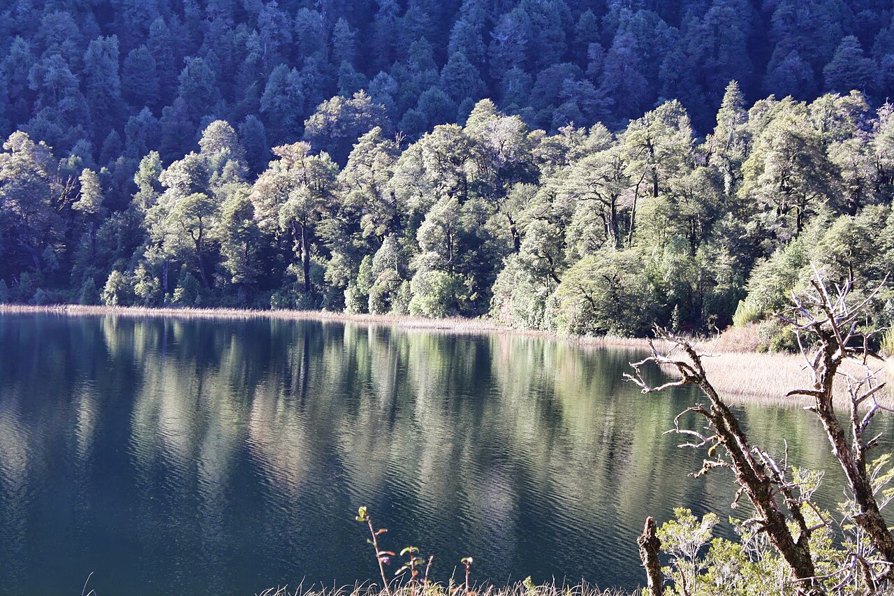
Slicing through the cold surface triggers an immediate rush of adrenaline that heightens sensory awareness, creating a profound, intimate bond with the surrounding elements. Waiting on the shore at the finish line, organizers welcome shivering competitors with steaming cups of hot chocolate and chocolate medals to celebrate their effort.
Winter solstice swim at Puerto Chalupa: about 10 °C (50 °F) water
The Natación de Aguas Frías at Puerto Chalupa on Lake Rupanco is timed for the winter solstice, at the turn from autumn to winter. The organizers give the water temperature at Playa Puerto Chalupa as about 10 degrees Celsius. Competitive swims are 1,000 meters without a wetsuit and 2,000 meters with one, while the 300-meter swim is a non-competitive event open to every entrant. In the no-wetsuit category, swimwear made of neoprene or rubber is not accepted, though neoprene socks and a neoprene cap are allowed. Swimmers bring their own gear for this self-sufficient event: goggles, earplugs, two caps or one neoprene cap and neoprene socks, with a tow float suggested. Playa Puerto Chalupa lies 11 kilometers south of Entre Lagos, in the commune of Puyehue, on the shore of Lake Rupanco.
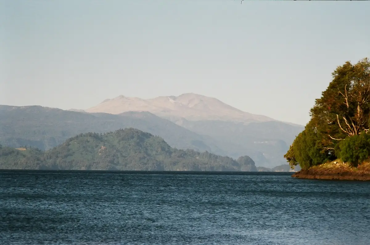
Lago Rupanco: deep blue clarity, plunging waterfalls, and glacial rivers
Below the surface, Lake Rupanco reveals astonishingly clear, deep blue water with visibility extending between eight and ten meters into the depths. The lake's vast basin is continuously supplied by a network of pristine southern waterways, receiving inflows from the Gaviota, Bonito, and Puleufú rivers before eventually draining westward into the Rahue River. Among these tributaries, the Río Frío—also known as both Estero La Cascada and the Puleufú River—descends steeply from the surrounding heights. The river drops 137 vertical meters through a sequence of three successive waterfalls before meeting the edge of Lake Rupanco. Where the torrent reaches the base of a high ravine, it deposits sand and gravel into the lake bed, forming a spit that extends 300 meters into the western waters. Across on the northern shoreline, the El Calzoncillo waterfall plunges down rocky faces toward the water, standing in clear view from the sands of El Islote beach.
Antillanca volcanic complex: calderas, craters, and steaming shores
The landscape framing Lake Rupanco is anchored by the Antillanca volcanic complex, which covers an area of 380 square kilometers about eight kilometers from the race area. This extensive volcanic field is bordered to the west by Lake Puyehue and Lake Rupanco, rising alongside native forests and stark Andean summits. Its vast topography shapes the local basin, creating an amphitheater of wilderness that swimmers face from the moment they step into the water. A massive caldera measuring 4.5 kilometers in diameter was formed during the Holocene epoch, and today it encloses the Casablanca stratovolcano. Along the western margin of this ancient caldera sits the Raihuén explosion crater, adding to the dramatic volcanic terrain.
Thermal activity surfaces directly along Lake Rupanco's northeastern shore, where hot springs reaching high temperatures were recorded in 1869. This powerful geological environment has left notable traces across history: during the 1960 Valdivia earthquake, a massive landslide caused a ten-meter wave across the lake that destroyed the Hotel Termas de Rupanco. Today, the surface of the lake remains an open, tranquil expanse where swimmers navigate clear, quiet waters framed by green slopes.
Termas de Puyehue and Aguas Calientes: ancient healing waters
Located about six kilometers from the race area within Puyehue National Park, the Aguas Calientes springs emerge naturally right beside the Chanleulfú River. About eight kilometers from the swim site, the healing properties of the Puyehue thermal springs were known to the Pitrén culture, the predecessors of the indigenous Huilliche people. Seven thermal springs emerge from a conglomerate bed of pebbles and yellowish clay, with natural warmth that fluctuates alongside changes in atmospheric conditions. The thermal site sits amidst swampy terrain covered in dense quila and tepú vegetation, between three and four kilometers from the eastern coast of Lake Puyehue. In the area just south of the baths, digging a shallow well reveals hot water steaming below the ground.
Historically, a steamship named El Vapor Puyehue transported visitors across the lake from the El Desagüe sector to Puyehue beach for thirty years. Just beyond lies Lake Puyehue, resting at an elevation of 212 meters above sea level with green water that warms in the southern summer month of January. Fed from the east by the Golgol River, the lake drains toward the sea through the Pilmaiquen River in the west. Following a major volcanic eruption in 2011, pumice stones floated across the lake surface, and volcanic particles deposited a layer of tephra between one and ten centimeters thick along the lake bed. The Golgol River itself originates in Lake Constancia, running for four kilometers between high hills and steep cliffs with seven distinct waterfalls, including a main drop of twelve meters.
Fed by snowmelt and ice from the Puyehue and Casablanca volcanoes, eighty-two percent of the Golgol basin remains preserved under the protected SNASPE system, ensuring that the cold waters of this volcanic lake country continue to flow wild and clean.
Sources: Lago Rupanco · Lago Puyehue · Huishue Lake · Termas de Puyehue · Complejo volcánico Antillanca · Termas de Aguas Calientes
Course
Promotional, non-competitive distance held at Playa Puerto Chalupa, Lago Rupanco.
Competitive distance for swimmers without wetsuits (textile swimwear only). Held at Playa Puerto Chalupa, Lago Rupanco.
Competitive distance for swimmers with wetsuits. Held at Playa Puerto Chalupa, Lago Rupanco.
Awards
- Age group awards
- Wetsuit/No-wetsuit separated
Medals for 1st, 2nd, and 3rd place in each age category for 1000m (no-wetsuit) and 2000m (wetsuit). General classification medals also awarded.
Useful info
Cold water swimming event. Categories divided by distance and wetsuit usage. Safety is managed by local maritime authorities. The second stage of the circuit is scheduled for August 22, 2026, at the Laguna Chica in San Pedro de La Paz.
How to get there
Nearest airport: Cañal Bajo (Osorno), 55 km away (1 hour travel time). Playa Puerto Chalupa is located 11 km south of Entre Lagos.
1ª fecha de la Natación de Aguas Frías
Frequently asked questions
- What distances does 1ª fecha de la Natación de Aguas Frías offer?
- 1ª fecha de la Natación de Aguas Frías offers 300 m, 1 km, and 2 km.
- Is a wetsuit required at 1ª fecha de la Natación de Aguas Frías?
- Wetsuits are permitted for the 2000m distance. For the 1000m distance, only textile swimwear is allowed; neoprene, rubber, or silicone materials are strictly prohibited.
- Where does 1ª fecha de la Natación de Aguas Frías take place?
- 1ª fecha de la Natación de Aguas Frías is a lake swim. Location: Playa Puerto Chalupa, Lago Rupanco, Puyehue, Los Lagos, Chile.
- How cold is the water at 1ª fecha de la Natación de Aguas Frías?
- The organizer states a water temperature of 10 °C (50 °F).
- How do I register for 1ª fecha de la Natación de Aguas Frías?
- The reference page for registering for 1ª fecha de la Natación de Aguas Frías is https://conquistachile.cl/competencia-internacional-naf-2026/.
Where to stay
Accommodations around Puerto Chalupa and the nearby town of Entre Lagos consist primarily of rustic eco-lodges and family-run mountain cabins. Visitors can find simple guesthouses often referred to as 'cabañas' that cater to outdoor enthusiasts, with prices typically ranging from $60 to $120 USD per night depending on proximity to the lakefront. During the winter season, booking in advance is essential as the limited capacity fills quickly with event participants.
Things to do nearby
The Puyehue region is defined by its thermal activity and volcanic landscape. Swimmers can visit the nearby thermal springs to recover in mineral-rich waters. Beyond the lake, the area offers extensive trekking trails within the national park, suitable for exploring the temperate rainforest. Kayaking and SUP are popular on the calmer sections of the lake, providing a different perspective of the surrounding Andean peaks and the dense foliage that characterizes this part of the Los Lagos region.
Swimmers
What to see around
1. Puyehue National Park (trekking and nature), 2. Termas de Puyehue (post-race relaxation), 3. Salto del Indio waterfalls, 4. Antillanca ski center (view of Casablanca volcano), 5. Lago Rupanco (hiking and kayaking).
Similar races


Comments
Transparency: some links on this page (stays, flights, experiences, gear) are affiliate links — if you book or buy through them, Omniathlon may earn a commission from the partner at no extra cost to you. As an Amazon Associate we earn from qualifying purchases.