
Mantaray Relevos - Laguna el Pino
- Dec 5, 2026
- Distances: 500m and 1km
At a glance
- Next edition date
- December 5, 2026
- Distances
- 500 m · 1 km
- Where
- Lake · Laguna El Pino, Barberena, Santa Rosa, Guatemala
- Entry fee
- 500 m: 250 GTQ · 1 km: 275 GTQ
- Registration
- instagram.com
About the race
Enclosed by dense stands of casuarina trees in Santa Rosa, Laguna El Pino offers a sheltered freshwater basin where relay teams trade sprint legs. Mantaray Relevos is an open water swimming race held in the freshwater lake of Laguna El Pino, situated in the municipality of Barberena within the department of Santa Rosa, Guatemala. The event centers on team relay racing, bringing swimmers together along the shore. Swimmers take on fast-paced courses over distances of 500 meters and 1,000 meters. The sprint distances demand immediate speed right from the start, as competitors push through calm lake water before tagging their teammates on the bank. The short laps reward sharp pacing, quick transitions, and tactical pack swimming close to the shoreline.
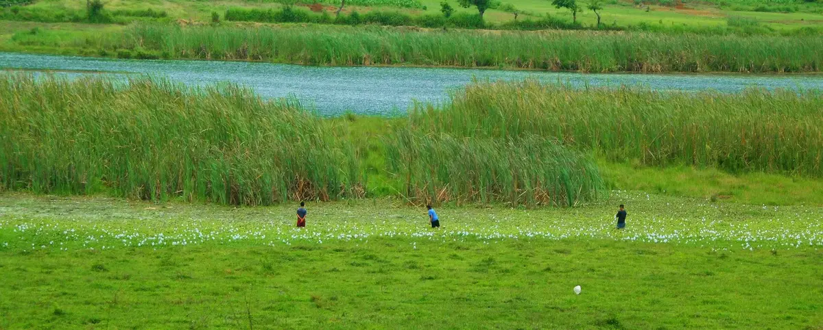
Laguna El Pino: national park waters and eighteen-meter depths
The lake where the course is set spans a surface area of 0.72 square kilometers, resting between the municipalities of Barberena and Santa Cruz Naranjo. Out on the course, swimmers move over deep, open water that reaches a maximum depth of 18 meters. That steady water depth gives the basin a quiet, sheltered consistency without the currents or breaking chop encountered along open coastlines. Laguna El Pino and sections of its immediate shoreline were established as a protected national park in 1955. The national park encompasses a total area of 0.73 square kilometers, preserving the tranquil character of the basin. Along the water's edge, land management is shared: government ownership accounts for 20 percent of the shores, while the remaining 80 percent belongs to private holdings that surround the lake.
Swimming and boating on Laguna El Pino
Laguna El Pino lies in the village of El Cerinal, in Barberena, Santa Rosa, 30 kilometres south-southeast of Guatemala City. At weekends visitors from Santa Rosa and from the capital come to Laguna El Pino for activities such as swimming, fishing, walks and family gatherings. The national forest institute Inab carries out permanent maintenance, cleaning, control and surveillance work at the lagoon. The lagoon water is used for subsistence fishing and for recreation including swimming, recreational fishing, water sports and trips in small boats.
Santa Rosa volcanic belt: Tecuamburro slopes and Barberena seismic springs
Farther into the highlands on the slopes of the Tecuamburro volcano lies Laguna de Ixpaco, perched at an altitude of 1,100 meters above sea level. Laguna de Ixpaco forms a circular water body measuring 350 meters in diameter, with a surface area covering 0.13 square kilometers. While Laguna de Ixpaco displays extreme volcanic heat, with water temperatures ranging from 25 degrees Celsius to nearly 100 degrees Celsius, Laguna El Pino provides a completely separate basin perfectly suited for open water competition. The contrasting water bodies reflect the diverse hydrology of the volcanic belt.
Laguna El Pino marshlands: water hyacinths, reeds, and birdlife
The aquatic ecosystem bordering the open water includes distinct plant communities adapted to the lake basin. Floating vegetation gathers in concentrations of water hyacinth, while submerged sections support clear beds of Canadian waterweed (*Elodea canadensis*). Swampy fringes of the lagoon feature *Eleocharis elegans* and California bulrush (*Scirpus californicus*). Swimmers navigating the race loop stay clear of these vegetated banks in the open waters. These vegetated margins make the national park a haven for local birdlife. Birdwatchers and swimmers resting along the shore can observe species such as the pied-billed grebe and the northern jacana. The wetland reeds also shelter cattle egrets, common moorhens, and American coots that populate the perimeter of the lake.
The southern shore of Laguna El Pino: casuarinas and ranchos
On the southern shore of Laguna El Pino, a stone wall serves as a lakeside seawall where visitors and competitors can wet their feet and step straight into the water. Beyond the race course, the park offers traditional lakeside recreation. On weekends and holidays, visitors can rent rowboats to paddle across the calm surface or take horseback rides along the shaded perimeter trails under the casuarinas. After swimming, visitors gather around designated park areas fitted with rustic ranchos and grills designed for outdoor cooking. Local vendors within the park grounds sell fresh fruit, hot lunches, and souvenirs, creating an easygoing lakeside atmosphere where relay teams can unwind and spend the afternoon beside the water.
Sources: Barberena · Laguna El Pino
Course
How to get there
Mantaray Relevos - Laguna el Pino
Frequently asked questions
- When is Mantaray Relevos - Laguna el Pino?
- Mantaray Relevos - Laguna el Pino takes place on December 5, 2026.
- What distances does Mantaray Relevos - Laguna el Pino offer?
- Mantaray Relevos - Laguna el Pino offers 500 m and 1 km.
- How much is the entry fee for Mantaray Relevos - Laguna el Pino?
- Entry fees by distance: 500 m: 250 GTQ · 1 km: 275 GTQ.
- Where does Mantaray Relevos - Laguna el Pino take place?
- Mantaray Relevos - Laguna el Pino is a lake swim. Location: Laguna El Pino, Barberena, Santa Rosa, Guatemala.
- How do I register for Mantaray Relevos - Laguna el Pino?
- The reference page for registering for Mantaray Relevos - Laguna el Pino is https://www.instagram.com/mantaray.gt/.
Where to stay
The area around Barberena offers rustic lodging options, primarily in converted coffee estate guesthouses and family-run lodges near the lakefront. Visitors typically find modest amenities in these properties, with prices ranging from $40 to $85 per night. For those preferring proximity to the water, small inland cabins provide basic shelter, though booking in advance is advised as inventory is limited during the December event window.
Things to do nearby
The Santa Rosa region is defined by its agricultural heritage and volcanic topography. Participants can organize visits to local coffee processing mills to observe the harvest cycle or hike the trails bordering the volcanic crater for panoramic views of the basin. The area also supports kayaking and sport fishing on the lake, while the cultural history of the former 'Corral de Piedra' can be explored through the remnants of early colonial architecture in the municipal center of Barberena.
Swimmers
Similar races



Comments
Transparency: some links on this page (stays, flights, experiences, gear) are affiliate links — if you book or buy through them, Omniathlon may earn a commission from the partner at no extra cost to you. As an Amazon Associate we earn from qualifying purchases.