
Thau Swim Trek 2026
- May 14, 2026
- Last edition date
- Distances from 2km to 10km
At a glance
- Last edition date
- May 14, 2026
- Distances
- 2 km · 5 km · 6 km · 10 km
- Where
- Lake · Étang de Thau, Sète, Occitanie, France
- Registration
- ats-sport.com
About the race
The Thau Swim Trek is an open water swimming event held across the saltwater expanse of the Étang de Thau beside Sète in southern France. Organized by THAU SWIM TREK, the event gathers endurance swimmers each May for an itinerary of point-to-point and circuit courses across the sheltered lagoon basin. The multi-day program begins in mid-May, opening beneath the night sky with the ThauSwimNight, a 2,000-metre course that tests nocturnal navigation across the ink-black water. Daylight competition begins the following morning with the longest challenge of the weekend, the 10-kilometre endurance crossing of La Mèzoise. Later that afternoon, the program shifts for La Bouzigaude, a 5-kilometre stage. The final day of the trek rounds out the lagoon circuit with two further distance events.
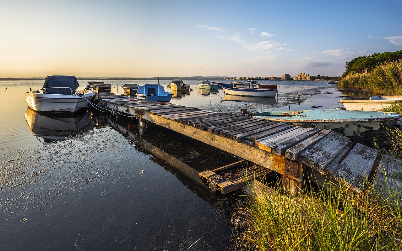
Swimmers first take on the 5-kilometre La Balarucoise in the morning, followed in the afternoon by the 6-kilometre La Sétoise. Over the course of the three days, participants swim across varied sectors of the inland basin, facing shifting surface ripples and the open horizon of one of the Mediterranean coast's most distinctive bodies of water.
The four stages from Marseillan to Sète
The Thau Swim Trek links Marseillan to Sète in several stages, passing through Balaruc-les-Bains on the way across the Étang de Thau. The first stage, La Mézoise, covers 10 km from Marseillan to Mèze on the Friday. La Bouzigaude follows the same day, a 5 km stage from Mèze to Bouzigues. Saturday brings La Balarucoise, 5 km from Bouzigues to Balaruc, and the 6 km La Sétoise from Balaruc to Sète. Between the oyster parks of Bouzigues, the organisers say swimmers will see the floating gardens of the shellfish farmers. The last stage finishes with a swim through Sète, where the organisers list the passage under the bridges and the noise of the town after the calm of the lagoon.
Étang de Thau: basin geology and submarine springs
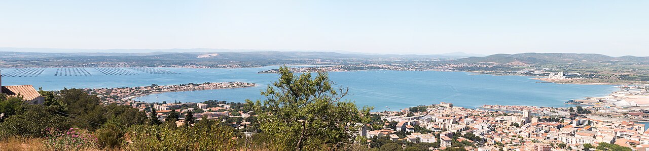
Sète lies nestled at the southeastern end of the Étang de Thau, an enclosed saltwater lake renowned throughout France for its extensive oyster and mussel farming. The town is interwoven with a historic network of canals that link the calm waters of the lagoon directly out to the Mediterranean Sea. While the lido strip shields the basin from open sea swells, modern conservation efforts remain essential to the shoreline, including a comprehensive plan established in 2004 to protect the Lido and mitigate coastal erosion along the sandy perimeter. Beneath the surface, the lagoon maintains a shallow profile with a mean depth of 4.5 metres, plunging to 10 metres only within the dredged central navigation channel.
Exchange with the open sea occurs through two distinct gateways: the commercial channels running through the port of Sète and a small maritime canal located at Marseillan Plage. Because the lagoon is semi-enclosed and relatively shallow, its water temperatures swing dramatically throughout the year, fluctuating between 3 °C (37 °F) during winter cold snaps and 29 °C (84 °F) under peak summer sun. Near the northern village of Bouzigues, the seabed drops into a remarkable 30-metre-deep depression that conceals a submarine thermal hot spring. This underwater vent discharges warm mineral-rich water from deep subterranean aquifers, serving as the geological source that supplies the renowned thermal spa at nearby Balaruc. Knowing that this deep geological fissure bubbles quietly below adds a sense of hidden wonder to the journey across the otherwise placid basin floor.
Balaruc and the lagoon: flamingos and Roman springs
The shallow, productive waters of the Étang de Thau sustain a thriving bird and marine ecosystem. Flocks of pink flamingos and elegant herons feed along the quiet shallows, sharing the coastal margins. Civilization has drawn upon the natural waters around Balaruc since ancient times. About five kilometres from the race area, the Romans constructed the Aqueduc de Balaruc during the 1st century to supply fresh water to the city and its celebrated thermal bath complex. Archaeological excavations at the aqueduct's intake mouth uncovered coins bearing the likeness of Emperor Claudius, confirming that the structure was engineered during the early 1st century. The Roman water intake was remarkably compact, measuring just 36 centimetres by 30 centimetres at the springhead. Across its entire route to the coast, the channel descended with an elevation drop of 8 to 9 metres, maintained at a steady, gentle slope of 1 to 1.3 metres per kilometre that demonstrated the refined hydraulic skill of antiquity.
Mont Saint-Clair: coastal batteries and maritime signals
Rising steeply between the Étang de Thau and the open Gulf of Lion, the promontory of Mont Saint-Clair commands the landscape of Sète. The rocky massif provides vital natural protection to the harbor below, sheltering vessels from the howling gusts of the northern mistral wind. High on the seaward slopes of the mountain, about one kilometre from the race area, sits Fort Richelieu, a coastal bastion begun in 1745 during the reign of King Louis XV. The stronghold was erected as part of a chain of coastal fortifications designed to protect the Languedoc shoreline during the 18th century. Naval vulnerability was a pressing concern in the region, particularly after British forces launched a direct raid on the port of Sète in 1710 during the War of the Spanish Succession.
By 1746, the defensive works of the town bristled with 52 cannons, overseen by a watchful garrison of soldiers and sailors assigned to lookout duty. The central battery of Fort Richelieu was built facing directly toward the sea, and the historic military property remains in the hands of the French Navy today. Higher up the slopes of Mont Saint-Clair, about one kilometre from the water, stands the Phare du Mont-Saint-Clair. Built between 1900 and 1903, the lighthouse was first lit on April 23, 1903, perched prominently above the town's famous marine cemetery. The tower is a handsome octagonal stone masonry structure rising 23 metres in height.
The Old Port of Sète and Canal Royal
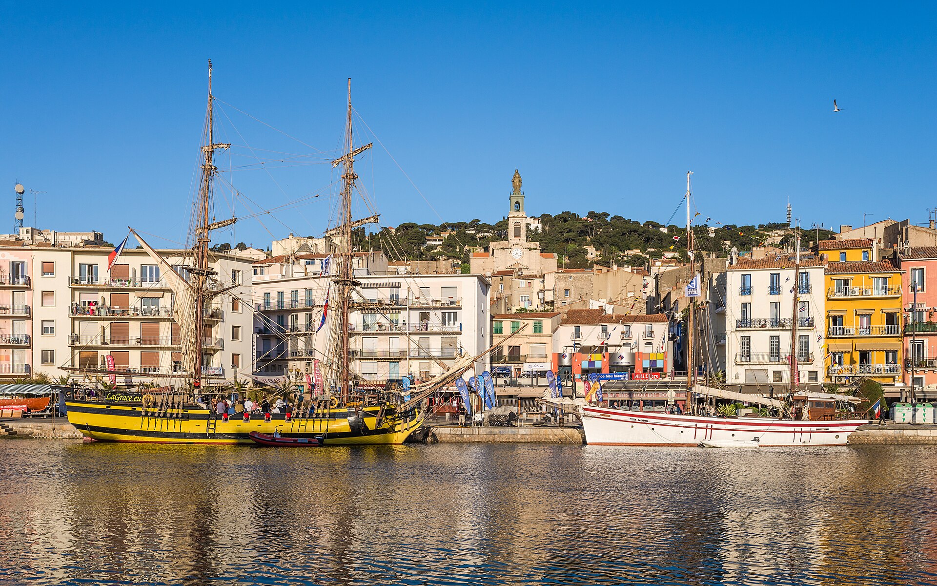
Between 1596 and 1605, King Henri IV and Henri I de Montmorency laid the foundations of the first organized port facility at the base of Mont Saint-Clair. Construction of the monumental Saint-Louis mole commenced on July 29, 1666, extending 650 metres to shield ships from fierce southeasterly gales, alongside the digging of the 2-kilometre Royal Canal that linked the lagoon to the sea. In 2016, the port of Sète celebrated its 350th anniversary, commemorating more than three centuries of seafaring life. Further harbor development continued into the 19th century with the construction of the town's massive offshore breakwater, which began in 1821 and reached completion in 1869. At the tip of the Môle Saint-Louis stands the historic Saint-Louis lighthouse.
The very first beacon here was erected in 1684 as a square stone tower burning tallow lamps. After successive rebuilds in 1690, 1720, and 1831—when it rose to 25 metres—the present lighthouse was constructed in 1861 using fine limestone from Cassis and fitted with an advanced Fresnel lens. The Vieux port de Sète remains a vibrant anchorage for traditional Mediterranean craft, including Languedoc jousting barques, wooden Catalan fishing boats, and classic Bantry yoles.
Sources: Sète · Phare du Mont-Saint-Clair · Étang de Thau
Course
ThauSwimNight event.
Stage from Mèze to Bouzigues (Day 1) and stage from Bouzigues to Balaruc (Day 2).
Stage from Balaruc to Sète.
Stage from Marseillan to Mèze.
Awards
Award ceremony scheduled for May 16th at 18:00.
How to get there
Thau Swim Trek 2026
Frequently asked questions
- When was the last edition of Thau Swim Trek 2026?
- The last edition of Thau Swim Trek 2026 took place on May 14, 2026.
- What distances does Thau Swim Trek 2026 offer?
- Thau Swim Trek 2026 offers 2 km, 5 km, 6 km, and 10 km.
- Where does Thau Swim Trek 2026 take place?
- Thau Swim Trek 2026 is a lake swim. Location: Étang de Thau, Sète, Occitanie, France.
- How do I register for Thau Swim Trek 2026?
- The reference page for registering for Thau Swim Trek 2026 is https://ats-sport.com/epreuve.php?id_epreuve=9180.
Where to stay
Sète offers diverse lodging, ranging from traditional apartments in converted fisherman’s houses near the old port to boutique hotels tucked along the canals. Camping options are available along the Lido de Thau, providing direct beach access. Expect to pay between €90 and €180 per night for standard double rooms, with prices rising during the weekend of the event. It is advisable to look for locations near the city center or the Quai d'Alger for easier access to the race start and logistics.
Things to do nearby
Beyond the water, the region is defined by its shellfish heritage; visiting the oyster beds in Bouzigues for a tasting is a local requirement. You can explore the slopes of Mont Saint-Clair via hiking trails that offer panoramic views of the Mediterranean. For a different perspective, kayaking or paddleboarding in the calmer sections of the lagoon allows for a closer encounter with the local birdlife, while the town’s maritime museum provides context on the historical naval attacks and the local jousting tradition.
Swimmers
Similar races


Comments
Transparency: some links on this page (stays, flights, experiences, gear) are affiliate links — if you book or buy through them, Omniathlon may earn a commission from the partner at no extra cost to you. As an Amazon Associate we earn from qualifying purchases.