9ª Travessia Itaparica-Salvador (Ultramaratona 3ª)
- Nov 15, 2026
- Distance: 12km
At a glance
- Next edition date
- November 15, 2026
- Distances
- 12 km
- Where
- Sea · Praia do Porto da Barra / Praia do Búzio, Salvador, Bahia, Brazil
About the race
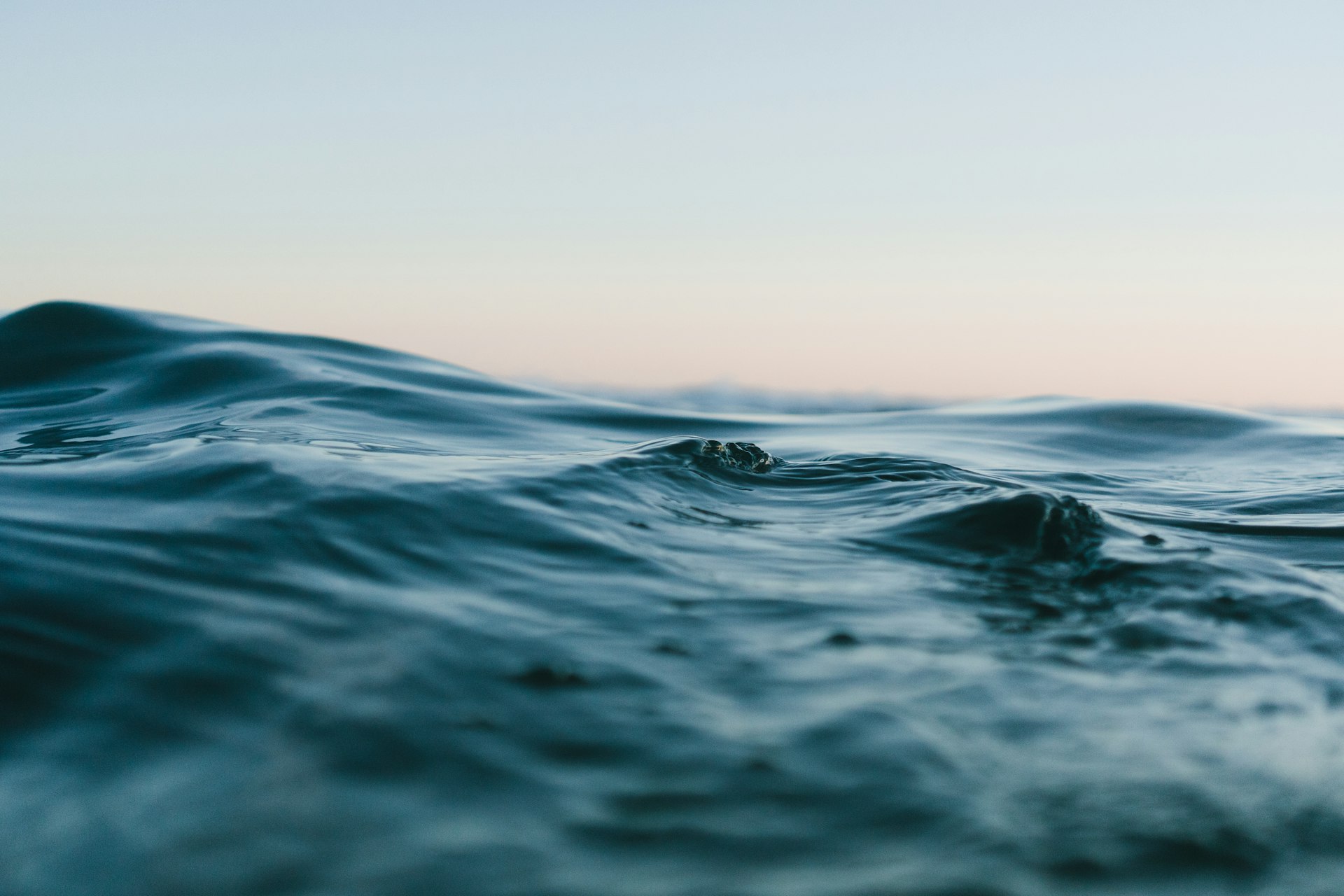
Twelve kilometres of open sea separate Itaparica Island from Salvador. The Travessia Itaparica-Salvador is an open water swimming ultramarathon held in the sea of the Baía de Todos os Santos, connecting Itaparica to the coast of Salvador in Bahia, Brazil. Organized by the FBDA - Federação Baiana de Desportos Aquáticos, the marathon tests swimmers across an expansive 12,000-metre course that spans the bay from Praia do Búzio on the island to Praia do Porto da Barra on the mainland. The event takes place in November, drawing marathon swimmers who gather to embark on a long journey across the open waters. Stepping onto the island beach on race morning, athletes face a true open water challenge that demands pace, navigation, and physical endurance across a vast stretch of open sea.
The competition was created in 1955 by journalist Genésio Ramos. Over the decades, pioneering athletes helped write the lore of the route, beginning with Marília Barreiros, who in 1957 became the first woman to complete the crossing. Half a century later, in 2006, Ana Marcela Cunha made history here by winning the competition at just 13 years of age. Every swimmer who takes on the course follows this established heritage, working through the rhythm of stroke and breath toward the distant mainland. The traditional arrival point awaits on the sands of Praia do Porto da Barra, which also serves as the finish line for the renowned Mar Grande-Salvador open water competition.
Baía de Todos os Santos: currents, corals and reef pools
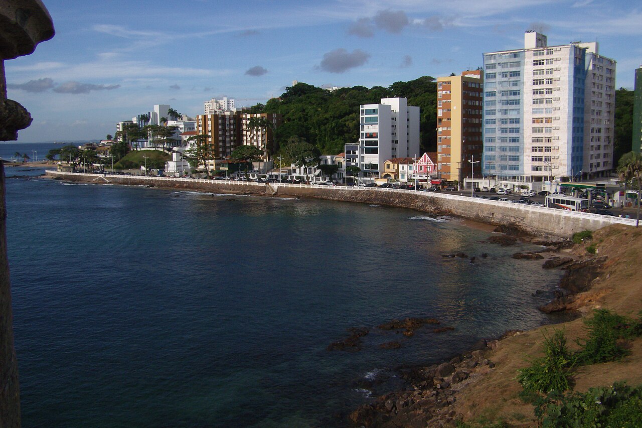
The city of Salvador sits on a prominent peninsula bounded by contrasting waters, bordered by the Baía de Todos os Santos to the west and the open Atlantic Ocean to the east. Across the mouth of the bay, the municipality of Vera Cruz on Itaparica lies only 5.5 kilometres from the city across the water, providing the setting for maritime crossings. While the open water route challenges swimmers with a sustained twelve-kilometre effort, the waters of the bay present reassuring swimming conditions that ease the crossing. Praia do Porto da Barra, situated on the shores of the Bay of All Saints, is nestled within a small cove where calm waves allow a smooth approach.
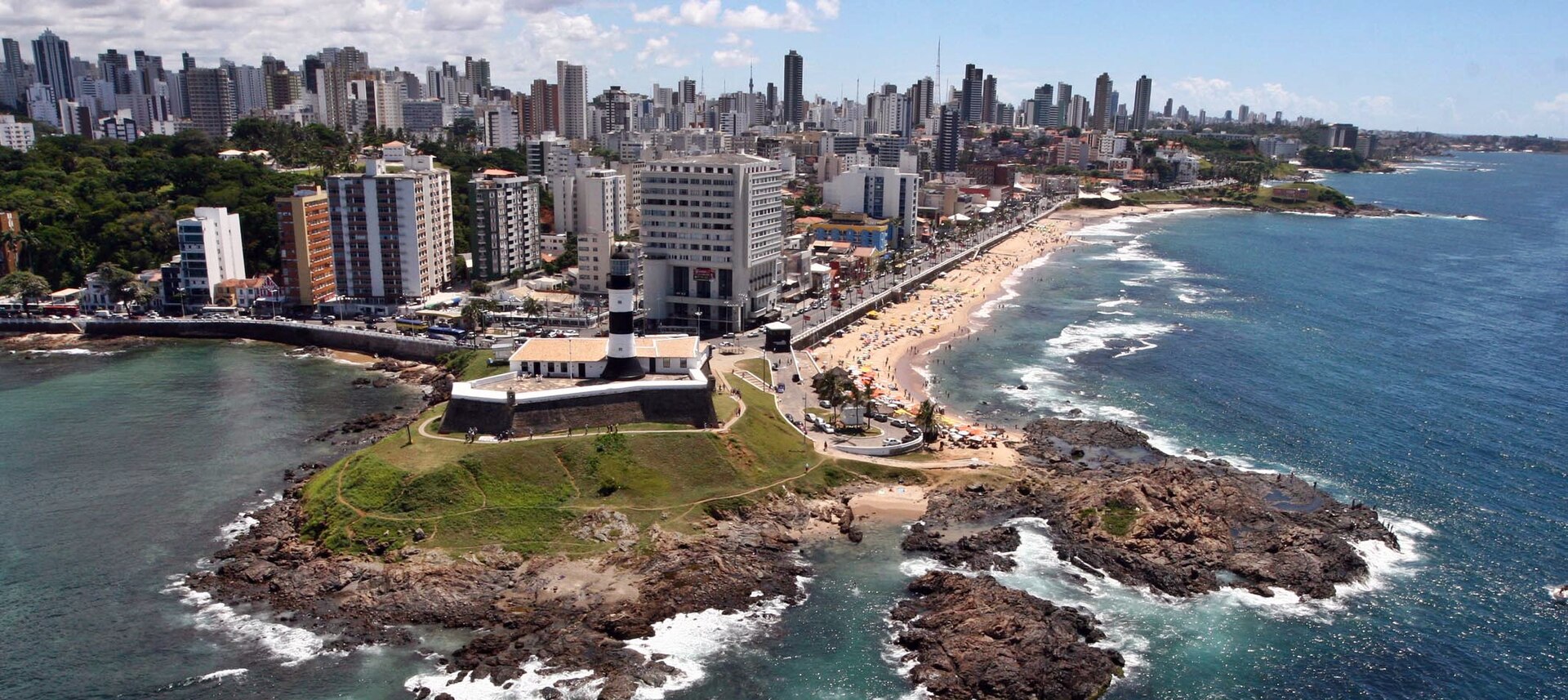
The wider coastline around the peninsula offers swimmers and traveling companions an exceptional variety of sea environments. Just beyond the bay at Praia do Farol da Barra, where the shore meets the Atlantic Ocean, coastal reefs protect stretches of the beach and create serene natural pools during low tide. Slightly further along the shoreline, the area near Christ Hill produces waves sought out for surfing. Tucked between Farol da Barra beach and Ondina beach lies Praia do Cristo, characterized by fine sand, scattered coastal rocks, and sheltered natural pools that invite relaxed bathing. Continuing along the Atlantic-facing shore, Praia de Ondina starts just past the Barravento restaurant near Morro do Cristo and extends as far as the Clube Espanhol. Its waters are generally crystalline, offering great conditions for leisure swimming and diving. Heading further north toward Rio Vermelho, a protected cove allows pleasant swimming at low tide before the rising tide welcomes local surfers.
From Caramuru to Piet Hein: naval history of the bay
Every nautical mile navigated between Itaparica and Salvador crosses water steeped in centuries of maritime history. Before Portuguese caravels entered the bay, the island of Itaparica was the domain of the indigenous Tupinambá people. European encounters began in 1510, when the navigator Diogo Álvaro Corrêa reached Itaparica; that same year, a French vessel was wrecked in these waters, leaving ashore survivors that included Diogo Álvares, famously known as Caramuru. Early Portuguese settlement took root nearby in 1536 when Francisco Pereira Coutinho established the Arraial do Pereira close to the modern Ladeira da Barra. The city of Salvador was officially founded on March 29, 1549, by Tomé de Sousa, who dropped anchor at Ponta do Padrão in Barra with six ships.
The colonial capital was built on two distinct levels: the Upper City, which housed religious and political authority, and the Lower City, entirely dedicated to commercial trading and maritime life. Across the water, Jesuits established a settlement at Baiacu on Itaparica in 1560, engineering what became the very first hydraulic works in Brazil. The wealth of the island soon attracted foreign raiders, beginning with attacks by English corsairs in 1597 and continuing through repeated Dutch invasions between 1600 and 1647. The bay itself turned into a battleground on March 3, 1627, during the Battle in the Bay of São Salvador, when Dutch admiral Piet Pieterszoon Hein intercepted an enemy fleet of 34 vessels about thirteen kilometres from the race course, capturing between 22 and 25 ships.
To defend the anchorage and secure freshwater supplies at Água de Meninos, colonial authorities raised the Forte de Santo Alberto along the beach between the lower city and Itapagipe, roughly two kilometres away. The fort saw conflict during the Dutch invasion of 1638 when it guarded the beach flank, was later described in 1863 as an irregular hexagon with seven cannons, and eventually became separated from the sea by modern port developments. On July 2, 1823, it was from this very fort that a symbolic cannon shot authorized the departure of Portuguese forces from Brazil. Further along the shoreline, Praia da Boa Viagem served historically as a sheltered landing site for maritime goods.
The sea along Boa Viagem is calm and quiet, with gentle, weak waves breaking against narrow stretches of golden sand. This quiet cove has seen dramatic history of its own, enduring the 1755 tsunami that pushed water levels three metres higher. Today, it remains an essential setting for maritime culture, serving as the finish point for the traditional Bom Jesus dos Navegantes sea procession celebrated every New Year's Day.
Praia do Porto da Barra: fortresses and the sunset sea
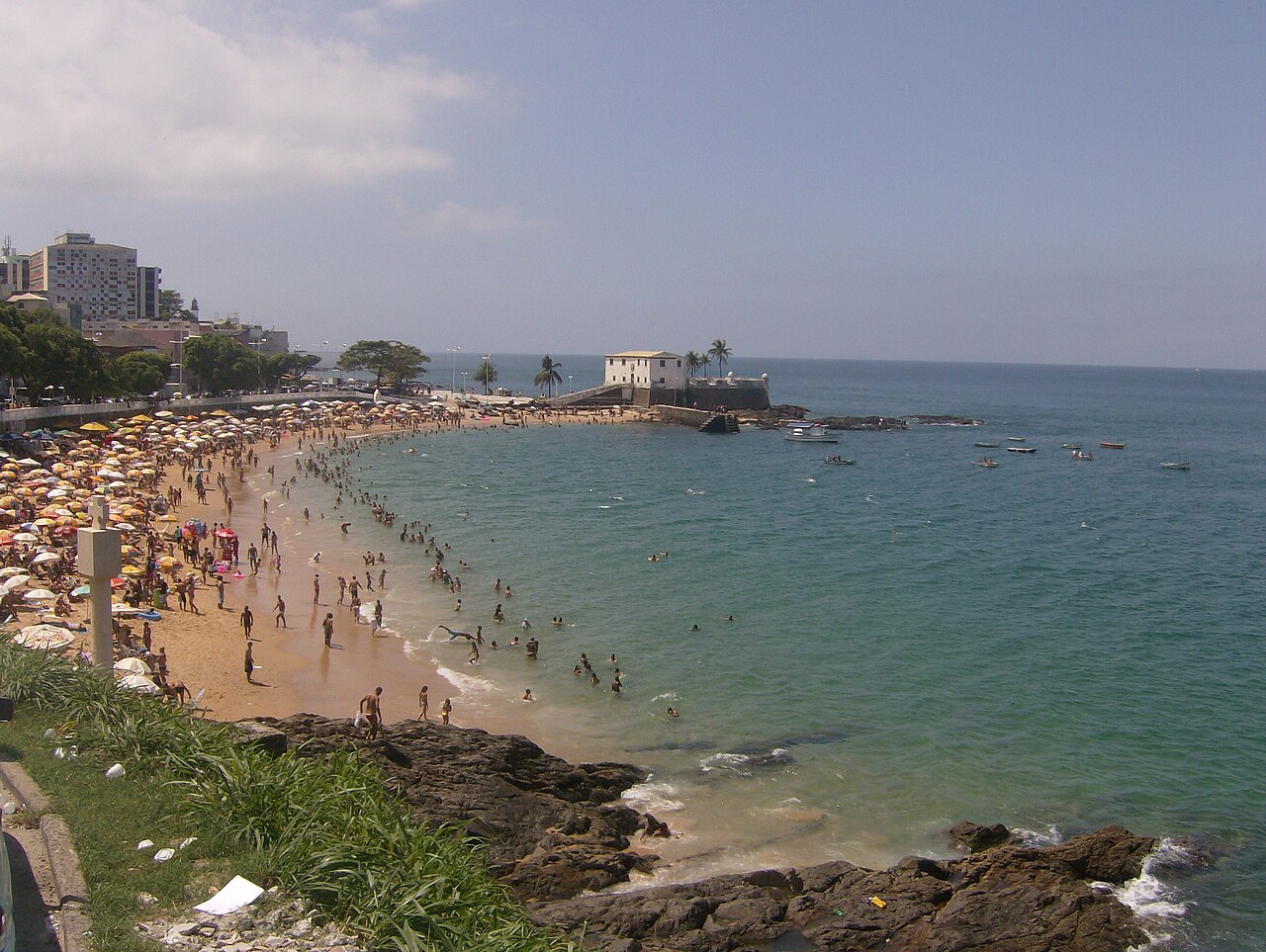
At Praia do Porto da Barra, the Santa Maria fortress is positioned right at the edge of the beach. Just along the adjacent shoreline, the beach of Praia do Farol da Barra sits framed between the Santo Antônio da Barra Fort and Christ Hill. A monument featuring a Portuguese cross marks the precise spot where the first Governor-General, Tomé de Sousa, came ashore. Beside the shoreline, a six-metre-high stone column stands directly on the beach, commemorating the very foundation of the city. After hours of swimming under the tropical sky, the cove offers a rare natural spectacle to close the day. Because the beach faces westward into the bay along this curved stretch of the peninsula, Praia do Porto da Barra is one of the exceptionally rare places on the Brazilian mainland where the sun sets directly over the open sea. Swimmers can rest on the golden sand, watch the sky turn amber across the water, and look back over the bay that carried them from Itaparica to Salvador.
Sources: Salvador
Course
Ultramarathon crossing from Itaparica Island to Salvador (Praia do Porto da Barra/Praia do Búzio). Open sea course across the Bay of All Saints.
How to get there
9ª Travessia Itaparica-Salvador (Ultramaratona 3ª)
Frequently asked questions
- When is 9ª Travessia Itaparica-Salvador (Ultramaratona 3ª)?
- 9ª Travessia Itaparica-Salvador (Ultramaratona 3ª) takes place on November 15, 2026.
- What distances does 9ª Travessia Itaparica-Salvador (Ultramaratona 3ª) offer?
- 9ª Travessia Itaparica-Salvador (Ultramaratona 3ª) has a single distance: 12 km.
- Where does 9ª Travessia Itaparica-Salvador (Ultramaratona 3ª) take place?
- 9ª Travessia Itaparica-Salvador (Ultramaratona 3ª) is a sea swim. Location: Praia do Porto da Barra / Praia do Búzio, Salvador, Bahia, Brazil.
Where to stay
Accommodations in Salvador range from restored colonial mansions in the Pelourinho district to modern boutique hotels overlooking the Porto da Barra harbor. For those preferring a more local experience, small guesthouses often operate out of traditional townhouses. Prices typically vary between €60 and €150 per night, depending on the proximity to the waterfront and the level of service. During the event weekend, booking near the Barra neighborhood is recommended for easier access to the finish line logistics.
Things to do nearby
The weekend offers a chance to explore the region's cultural heritage, from guided tasting tours of traditional Bahian acarajé to kayaking excursions through the calmer sections of the bay. Visitors can trek through the historic streets of the Cidade Alta to visit the various cathedrals or take a ferry to Itaparica to explore the island's colonial-era fortifications. For those interested in archaeology, the local maritime museums provide context on the many shipwrecks that have shaped the bay's history over the last five centuries.
Swimmers
Similar races


Comments
Transparency: some links on this page (stays, flights, experiences, gear) are affiliate links — if you book or buy through them, Omniathlon may earn a commission from the partner at no extra cost to you. As an Amazon Associate we earn from qualifying purchases.