
Shipwreck Swim
- Distances from 1.9km to 12km
At a glance
- Distances
- 1.9 km · 2.5 km · 3.7 km · 6 km · 12 km
- Where
- Sea · Bloubergstrand, Western Cape, South Africa
- Wetsuit
- Water temperatures are generally cold, averaging between 12 and 15 degrees Celsius.
- Registration
- bigbayevents.co.za
About the race
Off Bloubergstrand, open water swimmers plunge into the ocean to circle the resting place of a modern cargo vessel. The Shipwreck Swim is an open water sea competition staged in Table Bay along the coast of Bloubergstrand, a seaside suburb of Cape Town in South Africa's Western Cape. Organized by Big Bay Events, the race was directly inspired by the 2009 grounding of the Turkish bulk carrier Seli 1, which ran aground offshore. The course launches directly off the sandy beach, sends swimmers out through the breakers to round the shipwreck, steers northward past the rocky point that separates Small Bay from Big Bay, and finishes right in front of the local Lifesaving Club.
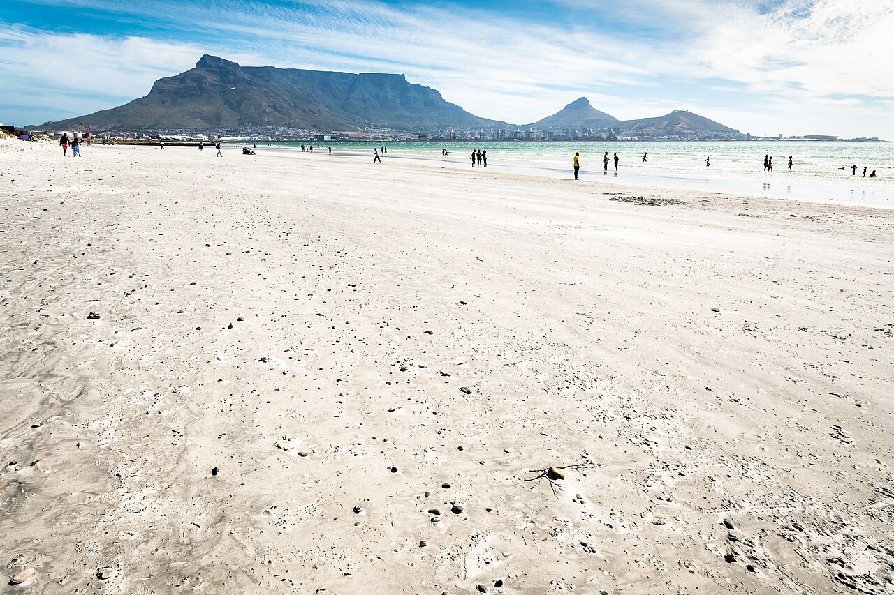
Competitors tackle a range of course options designed for different levels of distance endurance, featuring distances of 1,852 meters, 2,500 meters, 3,704 meters, 6,000 meters, and a grueling 12,000-meter marathon swim. Entering the water in Table Bay requires steady composure against the low temperatures of the South Atlantic, where race days typically average around 13 degrees Celsius and dipped as low as 11 degrees during a past edition. While the initial plunge brings an undeniable shock to the skin, swimmers quickly settle into a powerful rhythm, aided along the route by a fast prevailing coastal current that carries them swiftly toward the finish line.
From wreck to buoy: the Seli 1 and the Shipwreck races
The Seli Shipwreck Races run by Big Bay Events, reported on 30 January 2014 in their third running, were won by PJ Duffy of Port Elizabeth against cold water and the south-easter wind. Duffy finished the 5 km swim from Blouberg to Big Bay in just under an hour. The organiser said the cold water and heavy surf made the day very challenging for the 37 competitors, who also faced a strong south-easter. The removal operation disposed of the Seli 1 wreckage by cutting it into smaller pieces to hasten its collapse and dispersion on the sea floor. In 2015 a marker buoy was anchored on the shallowest point of the wreckage.
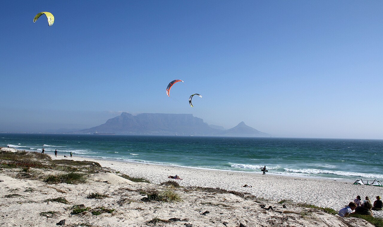
Table Bay: storms and the Tavern of the Seas
Swimmers at Bloubergstrand trace the rim of an immense oceanic basin, as Table Bay spans approximately 100 square kilometers and reaches a maximum depth of 35 meters at the center of its mouth. European mariners first navigated these waters in 1503, when Portuguese navigator António de Saldanha dropped anchor inside the shelter of the bay. A century and a half later, on April 6, 1652, Jan van Riebeeck arrived to establish a revictualing station on the bay shore, transforming Cape Town into what became known as the Tavern of the Seas for sailing ships needing food and water along the grueling passage around the Cape. The Castle of Good Hope, raised on the bay shore in the following decades, had its original sea gate facing the incoming tides until builders relocated the entrance in 1682, welcoming sailors into an interior that by 1685 contained fresh-water springs alongside fertile orchards of orange and lemon trees.
Early coastal defenses were anchored along the sandy shores as early as 1654, when Dutch settlers raised two defensive redoubts, Kyckuit and Duijnhoop, right at the mouth of the Salt River. High above the ramparts of the castle, a bell cast in Amsterdam in 1697 rang out to alert citizens across distances of up to 10 kilometers whenever danger threatened the settlement. Yet despite all the fortified works on shore, ships anchored in the roadstead remained desperately exposed to the fury of winter storms blowing straight onto the coast, where severe northwesterly gale waves repeatedly drove wooden sailing vessels onto the sand throughout the 17th and 18th centuries. Catastrophes at sea were frequent, including the loss of the British warship HMS Sceptre, which was destroyed by a violent hurricane in Table Bay on November 5, 1799.
In 1858, another ferocious winter storm wrecked no fewer than 30 vessels along the shore in a single tempest. The disaster prompted Lloyd's of London to refuse maritime insurance coverage for ships anchored in the bay, forcing the British Colonial Government to begin building the harbor's first protective stone breakwater in 1860. Maritime commerce transformed Table Bay over the subsequent century, leaving occasional scars such as the November 1953 spill from the Dutch tanker Sliedrecht that contaminated the local shoreline. Today, the modern container terminal at the Port of Cape Town, roughly 12 kilometers south of Bloubergstrand, operates rubber-tired gantry cranes equipped with sophisticated anti-sway systems designed specifically to keep freight moving during the region's fierce winds.
Green Point and the guiding lights of Table Bay
Down on the western hook of the bay, approximately 13 kilometers across the water from Bloubergstrand, stands the Green Point Lighthouse, the oldest operational lighthouse on the entire South African coastline. The first official lighthouse in South Africa had begun throwing its beam across Table Bay on April 12, 1824, relying on lamps fueled by whale oil. Just down the shoreline, Three Anchor Bay carries a name recorded as early as 1661, believed to describe heavy mooring anchors that held defensive chains spanning the inlet. Today the bay serves as the operational headquarters of the National Sea Rescue Institute, safeguarding swimmers and boaters across the Cape.
Robben Island: reefs, seals and African penguins
Robben Island rests within Table Bay. Geologically underlain by the Tygerberg Formation, the island is a flat landmass carved out by ancient erosion, measuring 3.3 kilometers in length and 1.9 kilometers across. Early Dutch settlers named it after their archaic term for the seals that hauled out across its shores, but the surrounding waters also supported industry, including a commercial whaling station founded at Murray's Bay on its northeastern shore in 1806. The powerful Atlantic surf and shallow reefs encircling the island made it a graveyard for passing vessels, with at least 31 recorded shipwrecks scattered across the surrounding seabed. Before formal lighthouses existed, keepers tended open warning fires fueled by coal, pitch rings, and wax candles on Minto Hill—then aptly known as Vuurberg—which served as the very first navigational light established south of the equator.
In 1865, authorities replaced the fires with an 18-meter cylindrical stone lighthouse erected atop Mintoheuwel, the island's highest elevation point. Electrified in 1938, the Robben Island Lighthouse remains the only navigation light in South Africa that produces a flashing signal without a rotating mechanism. In the cold, nutrient-rich Atlantic waters surrounding the island, wildlife thrives alongside maritime history; the rocky shores support a breeding colony of African penguins that numbered around 16,000 birds in 2004 before declining to about 3,000 individuals by 2015. Rounding the Seli 1 places open water swimmers directly into this living seascape.
Sources: Table Bay · Bloubergstrand
Course
Useful info
The provided site is an event management and water safety page (Big Bay Events) and does not contain specific details, course maps, or logistical information for the 'Shipwreck Swim' race.
How to get there
Airport: Cape Town International (CPT), 25km. There are no direct trains to Bloubergstrand; Uber or car rental from the airport is recommended (30 min via N1/R27). Parking is available along Marine Drive, but it fills up quickly during events. The area is served by the MyCiTi bus system.
Shipwreck Swim
Frequently asked questions
- What distances does Shipwreck Swim offer?
- Shipwreck Swim offers 1.9 km, 2.5 km, 3.7 km, 6 km, and 12 km.
- Is a wetsuit required at Shipwreck Swim?
- Water temperatures are generally cold, averaging between 12 and 15 degrees Celsius.
- Where does Shipwreck Swim take place?
- Shipwreck Swim is a sea swim. Location: Bloubergstrand, Western Cape, South Africa.
- How cold is the water at Shipwreck Swim?
- The organizer states a water temperature of 13 °C (55 °F).
- How do I register for Shipwreck Swim?
- The reference page for registering for Shipwreck Swim is https://bigbayevents.co.za/events/big-bay-swim-events/.
Where to stay
Bloubergstrand offers a range of stays, from compact beachfront apartments to modern boutique guesthouses overlooking the bay. You can find independent holiday rentals within walking distance of the start line. Prices typically range from $60 to $180 per night, depending on the proximity to the shoreline and the season. Booking in advance is recommended, as the area is a popular destination for water sports enthusiasts throughout the year.
Things to do nearby
Beyond the water, the area is defined by its proximity to the Cape Town city centre and the natural trails of the Blaauwberg Nature Reserve. Visitors often explore the coastal hiking paths that offer elevated views of the bay, or head to local surf shops to rent gear for SUP or surfing. The nearby West Coast area also features several vineyard estates offering tastings, providing a quiet contrast to the intensity of the coastal swim.
Swimmers
What to see around
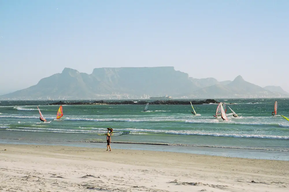
1. Table Mountain (hiking or cable car), 2. Robben Island (historical ferry tour), 3. V&A Waterfront (shopping and restaurants), 4. Rietvlei Nature Reserve (birdwatching and kayaking), 5. Kite-surfing at Big Bay (world-famous spot).
Other races by this organiser
- Lighthouse To Big Bay SwimCape Town, ZA
Similar races



Comments
Transparency: some links on this page (stays, flights, experiences, gear) are affiliate links — if you book or buy through them, Omniathlon may earn a commission from the partner at no extra cost to you. As an Amazon Associate we earn from qualifying purchases.