
28ª Travessia do Canal a Nado SOAMAR — Santos
At a glance
- Where
- Sea · Santos, São Paulo, Brazil
- Registration
- instagram.com
About the race
The 28ª Travessia do Canal a Nado SOAMAR — Santos is an open water sea race organized by SOAMAR Santos that tests swimmers across the sea in Santos, in the state of São Paulo, Brazil. Taking on this sea crossing means swimming in the wake of centuries of nautical tradition, connecting the secluded shoreline of Guarujá directly with the bustling bay of Santos. In past editions, the 1,650-metre course has traced a direct line from Praia do Góes in Guarujá across the estuary entrance to Praia da Aparecida in Santos. In earlier years, the race route also linked Praia da Aparecida directly with the Fortaleza da Barra across the water.
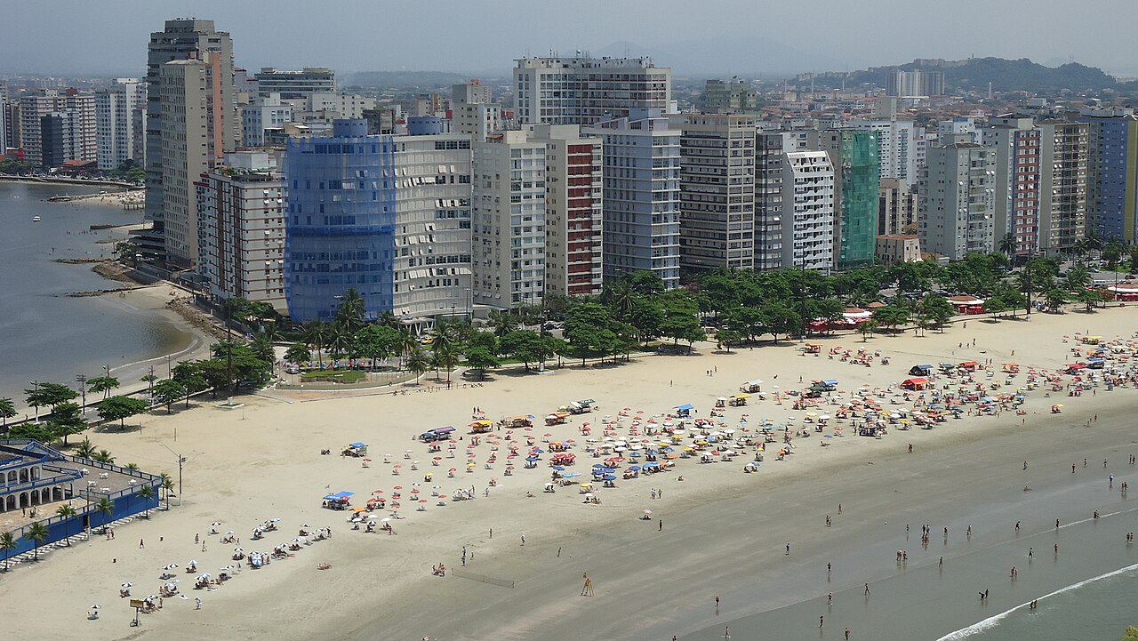
Crossing the deep shipping channel presents a demanding yet invigorating swim, where open sea swells and channel currents test sighting and stroke efficiency under attentive water safety support and clear course signage. Swimmers consistently highlight the high water quality and the stimulating atmosphere of navigating across the main mouth of the bay.
December on the Santos channel: the 27th SOAMAR crossing
The Travessia do Canal a Nado SOAMAR is traditionally held in December, because of the anniversary of the Navy and of the organising body. The 27th edition covered 1,650 metres from Praia do Góes in Guarujá to Praia da Aparecida in Santos, between canals 5 and 6 at the level of Avenida Escolástica Rosa. It brought together 476 swimmers, civilians and military, an all-time record for the event. There were 21 categories, 16 civilian and five military, with trophies for the first three in each. Bruno Arantes of the Círculo Militar de São Paulo won the men’s race in 15min28s. More than 30 support vessels accompanied the swimmers along the whole route.
Praia do Góes: colonial anchorage beneath the Atlantic forest
The crossing sets out from Praia do Góis, an intimate 250-metre cove inhabited predominantly by local fishermen and wrapped in coastal hills cloaked in Atlantic forest. Sheltered from the open ocean, the beach is characterized by remarkably calm waters that provide a peaceful gathering place before plunging into the channel. In December 1531, the colonizing expedition commanded by Martim Afonso de Sousa dropped anchor in front of this very beach. A small fortification was later constructed on the cove's shore to support the Fortaleza de Santo Amaro da Barra Grande and prevent unauthorized vessels from entering the Bertioga channel. Just along the same headland, the neighboring Sangava beach offers another glimpse of Guarujá's secluded coastline, framed by steep shores that descend rapidly into deep water.
Unlike the exposed oceanfront, Sangava features clear, calm waters unaffected by heavy waves or strong currents, where natural swimming pools form among the shoreline rocks. Starting from these tranquil wooded sands, swimmers push out, leaving the quiet green hills behind.
Santos Bay channel: Ilha da Moela and submerged shipwrecks
Out toward the open sea, roughly eight kilometres from the race course, the Ilha da Moela Lighthouse watches over the outer approaches to Santos Bay from an island set 1.84 kilometres off Ponta do Munduba. The rocky outpost, which currently serves as a Brazilian Navy base, has guided mariners toward the harbor entrance ever since its first beacon was lit in July 1830. Its existing lighthouse tower was inaugurated in May 1895, projecting a navigational beam from an elevation of 110 metres above the Atlantic waters. Those same waters have witnessed intense maritime history and navigational hazards over the generations. Approximately three kilometres from the swimming area, the steamship SS Guararema sank on the Santos bar near Ilha das Palmas on March 4, 1949, after colliding with the steamship Britannia.
Closer to the urban shoreline, about one kilometre from the course, ships were driven onto the sandbars, including the Elitel Fritz and the Madonna Della Costa in 1894. On February 11, 1895, the British barque Kestrel was stranded on Boqueirão Beach after a tropical storm snapped its anchor chain. Buried deep under the sand for more than a century, the wooden hull of the Kestrel resurfaced on Embaré Beach on August 22, 2017, when severe storm erosion stripped away the shoreline. Coastal changes had already altered the site, as roughly 1.5 metres of sand had been removed from the beach following the construction of Canal 5 in 1927. When exposed, the historic wooden wreck lay oriented with its stern right beside Canal 5 and its bow directed toward São Vicente.
Santos seafront: Saturnino de Brito canals and beachfront gardens
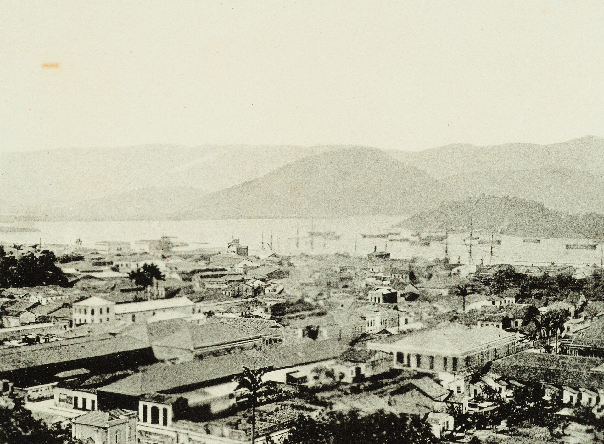
The city of Santos sits on the Island of São Vicente, an island first documented by Amerigo Vespucci in 1502. Maritime turmoil swept the coastline in 1591, when the privateer Thomas Cavendish raided the settlement and harbor, an event that birthed the enduring local legend of the miracle of Nossa Senhora do Monte Serrat. Centuries later, in the late nineteenth century, booming coffee trade through the port collided with severe sanitation issues and yellow fever epidemics, leading mariners to dread the anchorage as the 'port of death'. That grim reputation prompted a complete civil overhaul, led by sanitation engineer Saturnino de Brito, who designed an extensive network of drainage channels to sanitize the coastal city and drain the flood plains.
Stretching for seven kilometres along the open bay, the Santos seafront is celebrated for holding the Guinness World Record for the largest beachfront garden on earth. After navigating the deep waters between two historic municipalities, the finish line delivers you directly into the lively heart of one of Brazil's great coastal waterfronts.
Sources: Santos · Praia do Góis · Kestrel (barque) · Praia do Guaiúba · SS Guararema
Course
How to get there
28ª Travessia do Canal a Nado SOAMAR — Santos
Frequently asked questions
- Where does 28ª Travessia do Canal a Nado SOAMAR — Santos take place?
- 28ª Travessia do Canal a Nado SOAMAR — Santos is a sea swim. Location: Santos, São Paulo, Brazil.
- How do I register for 28ª Travessia do Canal a Nado SOAMAR — Santos?
- The reference page for registering for 28ª Travessia do Canal a Nado SOAMAR — Santos is https://www.instagram.com/travessiasoamarsantos/.
Where to stay
Santos offers a wide spectrum of lodging, ranging from functional apartments in the beachfront buildings along the Orla to boutique hotels situated near the port entrance and the historic center. Expect to pay between 250 and 600 BRL per night for mid-range options. During the race weekend, accommodations near the Boqueirão and Aparecida beaches allow for easy access to the finish line and the post-race logistics area.
Things to do nearby
The Santos waterfront is well-known for its extensive gardens and cycling paths. Beyond the water, visitors often explore the historical coffee exchange buildings, visit the aquarium, or take the funicular up to the Monte Serrat viewpoint. For a change of pace, local kayak and SUP tours navigate the quieter mangrove channels nearby, offering a look at the region’s biodiversity away from the main port transit lines.
Swimmers
Similar races


Comments
Transparency: some links on this page (stays, flights, experiences, gear) are affiliate links — if you book or buy through them, Omniathlon may earn a commission from the partner at no extra cost to you. As an Amazon Associate we earn from qualifying purchases.