
Around the Rocks Challenge
- Jan 10, 2016
- Last edition date
- Distance: 2.5km
At a glance
- Last edition date
- January 10, 2016
- Distances
- 2.5 km
- Where
- Sea · Big Bay, Bloubergstrand, Western Cape, South Africa
- Wetsuit
- Average water temperature is between 12 and 15 degrees Celsius.
- Registration
- bigbayevents.co.za
About the race
Sighting directly between the distant silhouettes of Table Mountain and Lion's Head, swimmers dive into the crisp Atlantic surf off Big Bay to round its jagged reefs. The Around the Rocks Challenge is an open water swimming race held in the cold sea waters of Big Bay, along the coast of Bloubergstrand near Cape Town in the Western Cape. Recognized as the oldest organized ocean swim in Cape Town, the event is organized by Big Bay Events and challenges participants over an open water distance of approximately 2,500 meters. The course takes competitors on an adventurous loop around the Big Bay rock islands, with organizers fine-tuning the exact circuit on race morning to match the size of the incoming Atlantic swell.
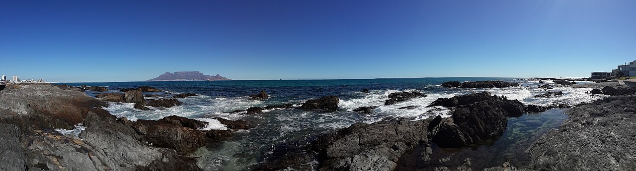
Stepping into the surf, swimmers must carefully line up their initial trajectory, aiming straight between Table Mountain and Lion's Head for the first 100 meters to steer clear of submerged rocks lurking beneath the breakers. Swimmers then bank right around a bright orange turning buoy, riding the sweeping tidal current to carry their stroke toward a second navigational mark. From there, the route cuts back into the bay, threading between jagged outcrops and passing directly alongside the local surfer lineup before swimmers catch the final waves back onto the sandy beach. Water temperatures in Big Bay typically hover between 12 and 15 degrees Celsius, demanding serious mental and physical composure as the Atlantic chill bites into the muscles.
In past editions, swimmers have encountered noticeable thermoclines during the crossing, with water temperatures plunging to around 11.6 degrees around the exposed outer rocks before warming up slightly as the route returns to the sheltered shallows near shore. Once through the surf zone and across the finish line, competitors find immediate comfort gathered together in the courtyard of the local lifesaving club, warming cold hands over steaming cups of hot chocolate and sharing jelly-filled donuts while waiting for the awards.
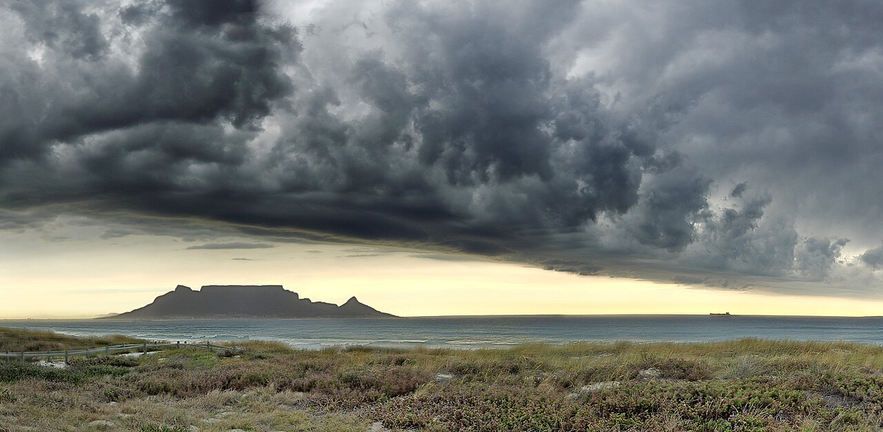
Robben Island: reefs, seals and shipwreck waters
Robben Island, out in Table Bay, was named after the archaic Dutch word for seals. Surrounded by jagged shorelines and treacherous offshore reefs, the island takes the full brunt of powerful Atlantic swells that roll into the bay, creating a notorious graveyard for navigating vessels. An underwater archaeological survey conducted in 1990 identified no fewer than 24 historical shipwrecks lying submerged around the island, with the vast majority resting in shallow waters less than ten metres deep. Alongside the sunken hulls, the island's marine ecosystem experienced a remarkable revival when African penguins re-established a breeding colony on its shores in 1983, a population that expanded rapidly to peak at approximately 16,000 individuals in 2004.
Guiding vessels past these treacherous shallows has challenged mariners for centuries, long before the construction of permanent navigational towers. The island's highest elevation, Minto Hill, was originally known by Dutch sailors as Vuurberg because lookout fires were lit atop its crest to warn incoming ships of the surrounding hazards. That primitive beacon became the first navigational light south of the equator, relying on wooden scaffolding where pitch rings, open wood fires, coal, and later wax candles were burned through the night. Today, Minto Hill is crowned by the Robben Island Lighthouse, an 18-metre-high cylindrical masonry tower completed in 1865 that remains the only lighthouse in South Africa to flash its beam without rotating, projecting a warning light visible from a distance of 25 kilometres out to sea.
Table Bay: storm waves and the Tavern of the Seas
Table Bay is a broad coastal embayment spanning approximately 100 square kilometres that plunges to a maximum depth of 35 metres at the centre of its mouth. European navigation in these waters began in 1503, when the Portuguese navigator António de Saldanha became the first European explorer to cast anchor within the sheltered natural harbour. Thanks to its role in provisioning trade fleets with fresh supplies midway through grueling voyages, Cape Town earned enduring renown as the Tavern of the Seas. Yet behind Table Bay's inviting anchorage lay lethal oceanic hazards, especially during the stormy winter months when ferocious northwesterly gales drove mountainous seas directly into the bay. Over the seventeenth and eighteenth centuries, countless sailing vessels were ripped from their moorings and driven relentlessly onto the jagged reefs.
Among the most famous casualties was HMS Sceptre, a British warship destroyed by a devastating hurricane on November 5, 1799, after being smashed onto the reef off Woodstock Beach near where the Royal Cape Yacht Club operates today. The maritime peril reached a catastrophic climax during a winter storm in 1858, when thirty vessels were wrecked against the shoreline in a single tempest, accompanied by tragic loss of life. When maritime underwriters at Lloyd's of London responded by refusing to insure ships anchoring in Table Bay during the dangerous winter season, the British Colonial Government was forced to take decisive protective action. Engineering work on the harbour's first permanent breakwater began in 1860, finally providing incoming ships with an engineered sanctuary from the punishing Atlantic storms.
Green Point and Milnerton: lighthouses of Table Bay
In 1926, engineers fitted the Green Point Lighthouse with a powerful foghorn that local Cape Town residents quickly dubbed Moaning Minnie; its luminous beam proved indispensable in July 1966, providing vital illumination during the rescue operation when the S.A. Seafarer ran aground. High above the bay on the slopes of Signal Hill, mariners took additional navigational cues from the Lion Battery, where the historic Noon Gun cannons continue to overlook the water. Originally cast in 1794 as 18-pounder smooth-bore muzzle loaders and mounted at the Imhoff Battery, the guns were once fired to alert residents across the inland valleys whenever transport ships entered the bay.
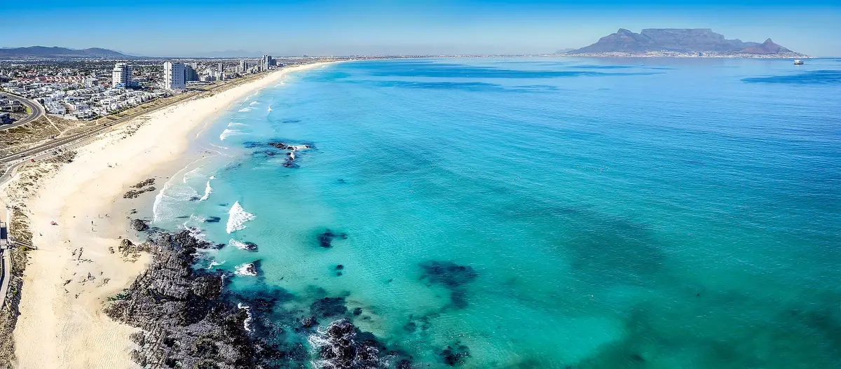
Sources: Table Bay
Course
The route involves swimming around the Big Bay rock islands. The exact distance and path are determined by the swell size on the day of the event.
How to get there
Airport: Cape Town International (CPT), 25km away. There are no direct trains to Bloubergstrand; Uber or car rental from the airport is recommended (30 min via N1/R27). The site is accessible by car with public parking available along Marine Drive. For cyclists, the area is well-served by coastal bike paths.
Around the Rocks Challenge
Frequently asked questions
- When was the last edition of Around the Rocks Challenge?
- The last edition of Around the Rocks Challenge took place on January 10, 2016.
- What distances does Around the Rocks Challenge offer?
- Around the Rocks Challenge has a single distance: 2.5 km.
- Is a wetsuit required at Around the Rocks Challenge?
- Average water temperature is between 12 and 15 degrees Celsius.
- Where does Around the Rocks Challenge take place?
- Around the Rocks Challenge is a sea swim. Location: Big Bay, Bloubergstrand, Western Cape, South Africa.
- How cold is the water at Around the Rocks Challenge?
- The organizer states a water temperature of 13 °C (55 °F).
- How do I register for Around the Rocks Challenge?
- The reference page for registering for Around the Rocks Challenge is https://bigbayevents.co.za/events/big-bay-swim-events/.
Where to stay
Bloubergstrand offers a range of stays, from modern apartments overlooking the surf to boutique guesthouses tucked into quiet residential streets. You will find several comfortable options for self-catering, which is the local standard for swimmers needing flexibility with their pre-race routine. Prices typically range from $60 to $150 per night depending on the proximity to the beach and the season. For a more traditional coastal atmosphere, many visitors choose properties within walking distance of the Lifesaving Club, ensuring easy access to the race start. Check our handpicked local stay options for more details.
Things to do nearby
Beyond the water, the area is defined by its dramatic coastline and maritime heritage. Kitesurfing is the dominant sport, with the steady winds of the bay drawing enthusiasts from across the globe. For those who prefer a slower pace, the coastal paths offer expansive views of Table Mountain, perfect for morning walks. You can also explore the local history through various memorials or sample regional wines at nearby estates. When you are not in the water, take the time to discover these nearby coastal activities to round out your visit.
Swimmers
What to see around
1. Table Mountain (hiking/cable car, 20km). 2. Robben Island (historical tour, ferry from V&A Waterfront, 15km). 3. Rietvlei Nature Reserve (birdwatching/water sports, 5km). 4. West Coast National Park (cycling/nature, 45km). 5. V&A Waterfront (shopping/dining, 18km).
Other races by this organiser
- Shipwreck SwimBloubergstrand, ZA
- Lighthouse To Big Bay SwimCape Town, ZA
Similar races


Comments
Transparency: some links on this page (stays, flights, experiences, gear) are affiliate links — if you book or buy through them, Omniathlon may earn a commission from the partner at no extra cost to you. As an Amazon Associate we earn from qualifying purchases.