
Oceanman Malta
- Oct 3, 2026
- Last edition date
- Distances from 500m to 10km
At a glance
- Last edition date
- October 3, 2026
- Distances
- 500 m · 1.5 km · 2 km · 5 km · 10 km
- Where
- Sea · Ghadira Bay, Mellieħa, Malta
- Entry fee
- 40–160 €
- Registration
- oceanmanswim.com
About the race
Twenty-three-degree Mediterranean water opens the course across Mellieħa Bay. Oceanman Malta · Ghadira is an open water sea swimming event organized by OCEANMAN at Għadira Bay in the town of Mellieħa, Malta. Held in early October, the event brings swimmers to the island. The schedule offers five distinct race options: a 500-meter sprint, 1,500-meter and 2,000-meter mid-distance swims, along with 5,000-meter and 10,000-meter marathon distances. Wading out from the shore of Għadira Bay, the seabed drops off remarkably slowly, remaining shallow for the first 10 to 15 meters from the waterline. That broad underwater platform allows swimmers to settle into their stroke cleanly before reaching deeper stretches of the bay. Navigating through the bay is straightforward, as bright turn buoys lead competitors across the clear sea.
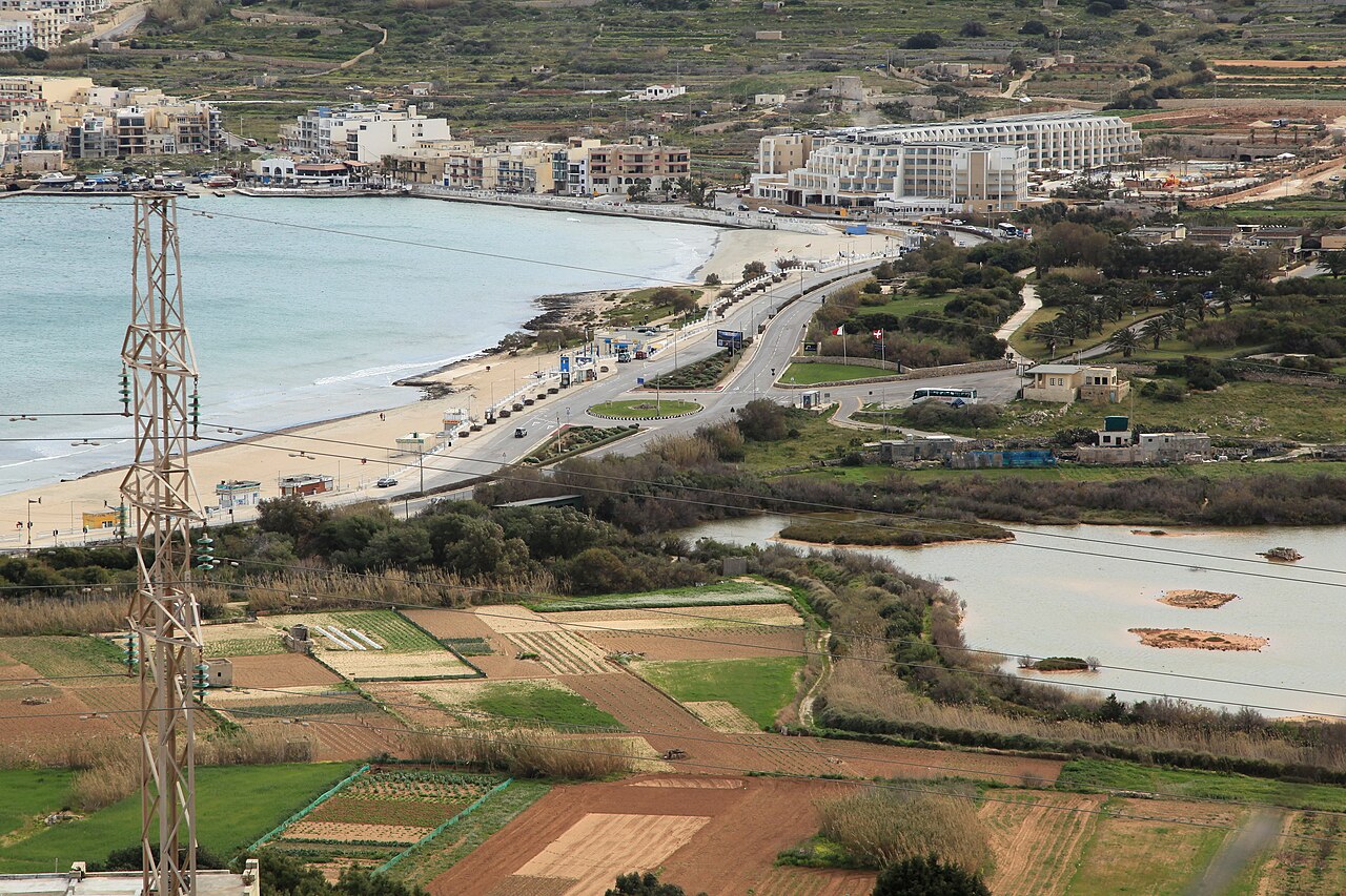
Mellieħa Bay between its two headlands
Mellieħa Bay, also called L-Għadira, is a sheltered beach between two headlands on the northern part of Malta. Some parts of Mellieħa Bay are designated for water sports and wind surfing. Between June and September the beach is managed by the Malta Tourism Authority together with the Mellieħa Local Council. The beach service includes lifeguards, a small First Aid clinic and two beach supervisors. An old castle is perched on one side of the bay, while the old village of Mellieħa lies high on the opposite side. The hinterland of Mellieħa Bay was once an important salt flat and wetland known as L-Għadira.
Għadira Bay: Malta's largest sandbar and protected shallows
Mellieħa Bay is renowned as the largest sandy beach on the island of Malta, stretching along the coastline for more than one kilometer. Its gentle gradient ensures that extensive shallows run out far from the shore, creating a safe natural haven for swimming and water sports. The bay holds Blue Flag status, an international environmental distinction that confirms high standards of water quality, safety, and environmental care. In the L-Aħrax green area of Mellieħa sits Armier Bay. This scenic coastal area consists of two separate sandy beaches named Armier and Little Armier. The water across the cove stands out for its crystal blue color, making it an inviting retreat for a post-race recovery swim.
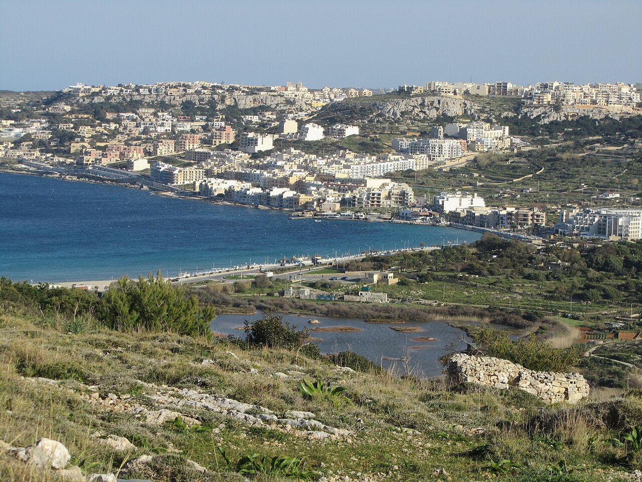
Numerous traditional boat houses line the shore of Armier Bay, utilized by local residents as summer homes right on the edge of the water. Golden Bay is defined by its gentle slope into the sea. Historically referred to as Military Bay, the inlet sits in the immediate vicinity of the Ghajn Tuffieha International Scout Campsite. Down the coast at Ġnejna Bay, steep clay slopes and limestone cliffs form striking headlands around a perennial freshwater spring. In the evenings, local fishermen continue to work the sheltered waters of Ġnejna using traditional night-time lamp fishing methods to haul their catch.
St Paul's Island: Roman anchors, corsairs and channel reefs
The seafloor around northern Malta holds deep layers of Mediterranean maritime heritage. On the seabed outside Salina Bay, marine archaeologists discovered a massive Roman-period lead anchor stock, recognized as the largest ever discovered anywhere in the world. Just offshore, St Paul's Island rises from the sea, sometimes divided into two parts by a shallow strait. In 1576, Barbary corsairs ran their vessel aground in the treacherous channel between the island and the mainland while chasing Marco di Maria, resulting in their capture. A watchtower was built on the island by Grand Master Giovanni Paolo Lascaris sometime after 1649. An imposing statue of Saint Paul, sculpted by Segismondo and Salvatore Dimech, was erected in 1844.
Underwater history is also submerged here: a statue named Kristu tal-Baħħara was sunk near the island in 1990, though it was later moved to Qawra Point because of poor water visibility. To the north in the Comino Channel, the British battleship HMS Sultan sank in 1889 after running aground on an uncharted submerged rock.
Coastal defenses from Westreme Battery to Lippia Tower
The Westreme Battery is an 18th-century artillery battery. Across the Selmun peninsula, the ruins of Għajn Ħadid Tower, constructed in 1658, perch over the secluded waters of Mġiebaħ Bay. On the northwest coast, Lippia Tower sits 100 meters above sea level, built in 1637 as an essential component of the island's coastal defense network against marauding corsairs. Nearby, a Second World War pillbox cleverly disguised as a traditional rural farmhouse remains preserved beside the bay. Further south along the island's western cliffs, Ras id-Dawwara lies along a dramatic line of cliffs that includes the Dingli Cliffs. The coast here is perforated with several sea caves located right at water level.
Looking across the water toward Comino, the rugged coastline is marked by limestone cliffs and deep sea caves that provided hideouts for pirates and marauders during the Middle Ages. St. Mary's Tower was erected on the cliffs in 1618 by the Knights of Malta to serve as a lookout against corsairs and smugglers. Saint Mary's Battery, constructed in 1716 to defend the South Comino Channel, still retains two original 24-pound iron cannons overlooking the channel. Life on Comino was so isolated that whenever rough seas prevented the priest from making the channel crossing, the local community used a flag code system to follow Mass celebrated across the water at the Chapel of Our Lady of the Rocks in Gozo.
Għadira Nature Reserve and northern Malta's marine havens
Directly behind the swimming beach, the Għadira Nature Reserve protects a habitat that serves as a vital refuge for protected water birds. Nature protection continues across the surrounding seas, with the island of Comino recognized as an Important Bird Area for its population of yelkouan shearwaters, alongside its designation as a Natura 2000 marine protected area. Immediately adjacent lies Cominotto, an uninhabited island of 0.25 square kilometres located between Malta and Gozo. Cominotto features a rugged coastline and rocky terrain, home to seabirds and predatory rats, and is protected as a Special Protection Area for its ecological value. The famous Blue Lagoon sits right beside Cominotto. On the mainland coast at the base of the Selmun peninsula, Mġiebaħ Bay is protected as an EU Natura 2000 Special Area of Conservation. Cradled below the northern headland of Ras il-Griebeġ, the beach spans roughly 200 metres of sand and pebbles. Together with the sweeping shallows of Mellieħa, these coastal sanctuaries make Oceanman Malta a distinctive journey through clear Mediterranean water.
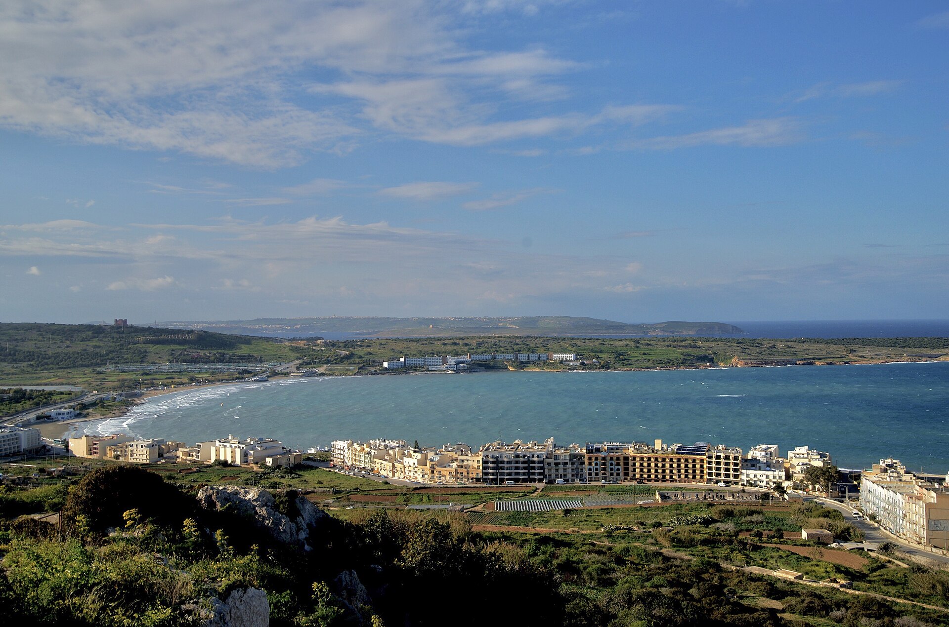
Sources: St Paul's Island · Mellieħa Bay · Mġiebaħ Bay
Course
Start and finish at Ghadira Bay. Compact sea-swimming course suitable for kids and short-distance participants.
Start and finish at Ghadira Bay. Part of the Oceanteams relay format.
Sprint distance course starting and finishing at Ghadira Bay.
Half Oceanman distance. Sea-swimming course starting and finishing at Ghadira Bay.
Full Oceanman distance. Sea-swimming course starting and finishing at Ghadira Bay.
How to get there
Airport: MLA
Oceanman Malta
Frequently asked questions
- When was the last edition of Oceanman Malta?
- The last edition of Oceanman Malta took place on October 3, 2026.
- What distances does Oceanman Malta offer?
- Oceanman Malta offers 500 m, 1.5 km, 2 km, 5 km, and 10 km.
- How much is the entry fee for Oceanman Malta?
- The entry fee ranges from 40 € to 160 €.
- Where does Oceanman Malta take place?
- Oceanman Malta is a sea swim. Location: Ghadira Bay, Mellieħa, Malta.
- How do I register for Oceanman Malta?
- The reference page for registering for Oceanman Malta is https://oceanmanswim.com/races/malta.
Where to stay
Mellieħa offers a mix of family-run guesthouses near the village centre and established boutique hotels overlooking the bay. For those preferring self-sufficiency, there are numerous apartments converted from traditional limestone houses available in the village outskirts. Prices typically range from €90 to €220 per night, depending on proximity to the Ghadira shoreline versus the elevated village views. Camping is strictly regulated in Malta, so most participants opt for the coastal hotels that provide direct access to the race start area.
Things to do nearby
Beyond the race, the northern peninsula is defined by its rugged coastal trails, particularly the path leading toward the Red Tower and the cliffs overlooking Comino. The area is a hub for sea-kayaking, allowing visitors to explore the small coves and sea caves that are inaccessible by foot. For a quieter afternoon, the nearby Għadira Nature Reserve provides a sanctuary for migratory birds, while the village of Mellieħa itself is known for traditional culinary experiences, often centered around fresh Mediterranean seafood and local honey-based pastries.
Swimmers
Other races by this organiser
- Oceanman Ayia NapaAyia Napa, CY
- Oceanman World Championship — MichesMiches, DO
- Oceanman Phang-NgaPhang-Nga, TH
- OCEANMAN GuanacasteGuanacaste, CR
- Oceanman KrabiKrabi, TH
- Oceanman CattolicaCattolica, IT
Similar races


Comments
Transparency: some links on this page (stays, flights, experiences, gear) are affiliate links — if you book or buy through them, Omniathlon may earn a commission from the partner at no extra cost to you. As an Amazon Associate we earn from qualifying purchases.